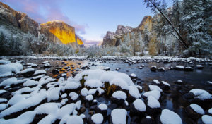
Right around the autumn equinox, dependable as your trusty compass, Yosemite Mariposa County spins into a lower gear. Peak Yosemite National Park visitation has passed, vehicle traffic lightens and animal traffic heightens and hiking trails — even in Yosemite Valley — are far less traveled. Fall is known by Yosemite insiders as prime time to be outside, and in this cooler, peaceful season Yosemite Mariposa County trails hold best-of-year appeal.
Continuing on this contrarian vibe, it’s a local secret that the weather actually gets better after summer. The sky goes a deeper shade of blue, temperatures trend lower, and photographers rave over a golden range of Sierra sunlight. Magic all around.
Whether you’re coming from the Bay Area, Los Angeles, cross-country or “across the pond”, here are the best fall hikes in Yosemite Mariposa County to share with your favorite trailmates. Get ready for that satisfying, sandy crunch of crushed granite under your boots!
The High Country Offers Yosemite’s Best Hikes in the Fall
As the hub of the Northern Yosemite region, Tioga Road (Highway 120 East) crosses the Sierra Nevada crest with its stunning 47-mile ribbon of alpine roadway. Indeed, the region is beautiful from the dashboard and even better from a hiking trail — especially when the kaleidoscope of fall colors takes hold.
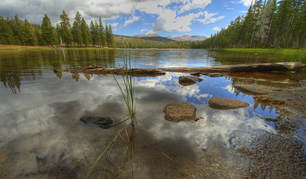
May Lake
Distance: 2.4 mi (3.9 km) out & back
Elevation Gain: 485 ft (150 m)
Difficulty: Easy
Trailhead: May Lake Parking Area
In addition to the popular backpackers’ High Sierra Camp located here, is a short & sweet high country day hike that leads to crystalline shores at the foot of Yosemite’s geographical center, Mt. Hoffman. From above, May Lake looks like a pine-ringed thumbprint on a high granite shelf, and at 9,270 feet (2,825 m) this “easy” hike can prove more challenging due to the thin mountain air.
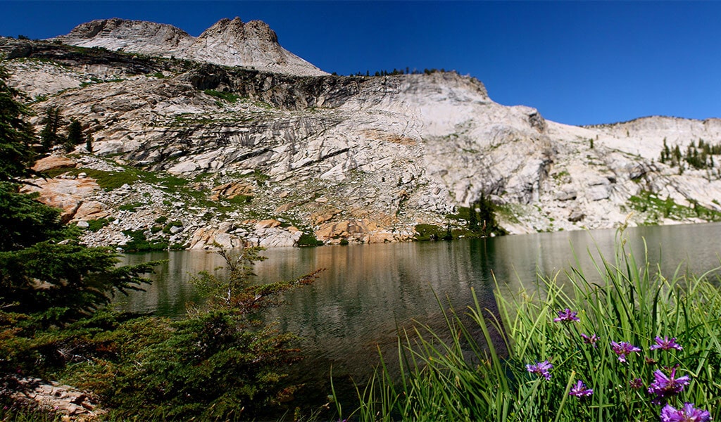
Lembert Dome (With Dog Lake Bonus Hike)
Distance: 3.4 mi (5.5 km) out & back from Lembert Dome parking area, or 1.8 mi (2.9 km) out & back from Dog Lake parking area (just west of Tuolumne Meadows Lodge).
Elevation Gain: 855 ft (261 m)
Difficulty: Moderate
Trailheads: Lembert Dome Parking Area & Dog Lake Parking Area
Looking like a granite wave rising from the pine forest, gazes across one of the largest and most beautiful High Sierra plateaus — Tuolumne Meadows. The long & steady shuffle lends itself to grippy sneakers, and for hikers who want a nice add-on continue to the supremely wadeable Dog Lake, which was named in 1898 by topographer Robert Marshall for his discovery of a sheepdog and her pups chilling by its shores.
Clouds Rest

Distance: 14.5 mi (23.3 km) out & back
Elevation Gain: 1,775 ft (541 m)
Difficulty: Strenuous
Trailhead: Sunrise Lakes Trailhead (near Tenaya Lake)
A knife’s edge of granite that resembles a breaching orca, Clouds Rest is one of the most spectacular fall hikes in Yosemite National Park. As trekkers make their careful way along this rocky promontory, they will be rewarded with 360-degree views that include Tenaya Canyon on one side, Little Yosemite Valley on the other, and Half Dome directly ahead (and below!). The biggest considerations when undertaking Clouds Rest are time and water. Set aside plenty of both!
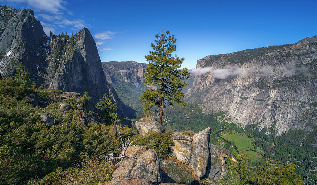
Yosemite Valley Hikes
Fall trail hikes in Yosemite Valley are unforgettable. With landmark peaks soaring above, warm days followed by cooler evening temperatures and a less hurried pace, hiking this time of year is a winner on multiple fronts. Peak Fall colors peak later here at the moderate 4,000 foot elevation valley, as late as mid-November.
Mirror Lake/Meadow Trail
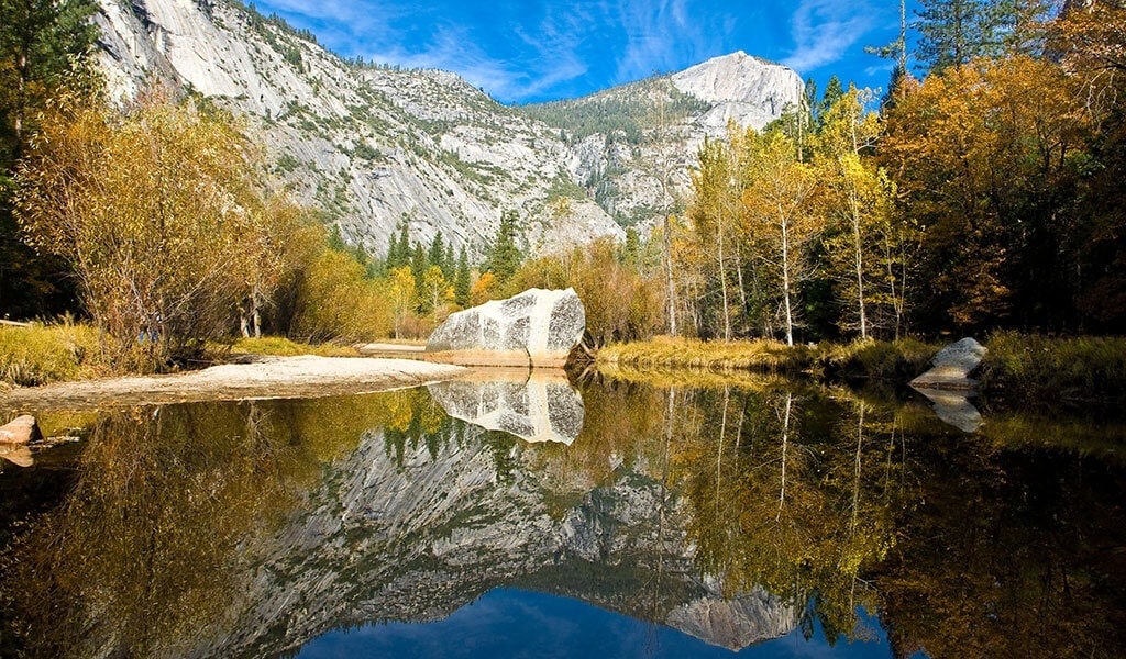
Distance: 2 mi (3.2 km) out & back, or 5 mi (8 km) loop
Elevation Gain: 100 ft (30 m)
Difficulty: Easy
Trailhead: Mirror Lake Trailhead (shuttle stop #17)
As fall in the Sierra takes hold, Mirror Lake becomes almost beach-like with sandy washes surrounded by stands of trees displaying their autumn colors. It’s a peaceful time, perfect for a picnic and easily accessible due the flat terrain and partially paved trail. Bonus points for spotting shy wildlife (coyotes, bobcats and the infrequent black bear) and the educational plaques that describe the local fauna, history of tourism (yes, we’ve evolved) and the Native American presence (including the Ahwahneechee name for Mirror Lake: Ahwiyah, meaning “quiet water”).
Valley Loop Trail

Distance: Your choosing, up to 13 mi (20.9 km) for full loop
Elevation Gain: Minimal
Difficulty: Easy to Moderate (depending on distance)
Trailhead: Shuttle stops and parking at multiple spots throughout Yosemite Valley.
The Yosemite Valley Loop Trail offers 13 modular miles where you can jump on and off at multiple points for a grand tour with skyward panoramic views of Yosemite’s monumental geology from the valley floor such as Cathedral Rock, Sentinel Rock and El Capitan. Though the waterfalls are a trickle by summer’s end, the fall foliage is an arboreal delight that more than make up for it.
Four Mile Trail
Distance: 9.6 mi (15.5 km) up & back
Elevation Gain: 3,200 ft (975 m)
Difficulty: Strenuous
Trailhead: Four Mile Trailhead
The mega-climb (and descent) of the Four Mile Trail begins in the shadow of Yosemite Valley’s Sentinel Rock along Southside Drive. It’s all switchbacks from here, following the route of a historic toll trail originally cut in 1871 by pioneer James McCauley, originator of the Yosemite Firefall. About two-thirds of the way up is Union Point — and a good spot to take a breather — until you reach one of the best vistas in Yosemite National Park — Glacier Point.
Southern Yosemite Hikes
Autumn treks in the Southern Yosemite region display a special kind of tranquility. Accessed from historic Fish Camp, these hikes feature rare trees and plummeting H2O making them an essential stop on your fall itinerary.
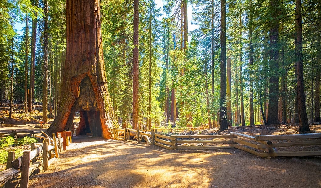
Mariposa Grove of Giant Sequoias
Distance: multiple routes, from .3 mi (.5 km) Big Trees Loop to 7 miles (11.3 km) Mariposa Grove Trail
Elevation Gain: minimal to 1,200 ft (366 m) for Wawona Point
Difficulty: Easy to Strenuous
Trailhead: Mariposa Grove Arrival Area
If your fall hike needs that special hook and you want lots of options when it comes to different trails, then how about some 3,000 year-old trees with names like Grizzly Giant, Fallen Monarch and Faithful Couple? The massive specimens are simply exquisite post-summer when visitation to Yosemite lightens, making this a key part of the Yosemite Mariposa Sequoia Tour that hits all our magical groves.
Chilnualna Falls
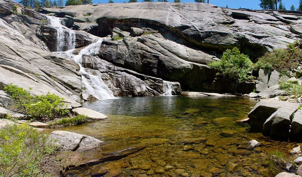
Distance: 8.2 mi (13.2 km) out & back
Elevation Gain: 2,400 ft (732 m)
Difficulty: Strenuous
Trailhead: Chilnualna Falls Trailhead
Beginning at 4,200 ft (1,280 m), play hide-and-seek with a series of cascades and cataracts ranging from 50 to 240 feet in height. Though it peaks in May, Chilnualna Falls flows year-round, while the steady climb is guaranteed to get your heart pumping. After your hike stop by the Yosemite History Center for some local sagas, or grab some grub & grog at the historic Wawona Hotel.
Central Mariposa County Hikes
In the Central Mariposa region, the warm temperatures hold out later into fall making for some perfect hiking weather at a time when the higher elevations are getting downright chilly. What’s even better? All are close to the hotels, restaurants and shops of the charming Gold Rush town of Mariposa.
Stockton Creek Preserve Trail

Distance: 4.4 mi (7 km) round trip (can be customized)
Elevation Gain: 500 ft (152 m)
Difficulty: Easy to Moderate
Trailheads: Trabucco Street Trailhead, or Hwy 140 Trailhead (just past intersection with Old Highway N)
The dog-friendly Stockton Creek Preserve Trail features several different routes that wind through a classic California oak and chaparral setting surrounding Stockton Creek Reservoir. It’s the perfect walk after enjoying a tasty meal just a few blocks away in the town of Mariposa, not to mention binocular-ready for birdwatching the fall migration.
Merced River Trail
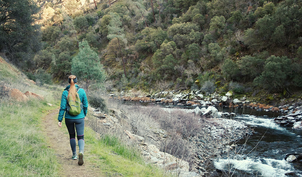
Distance: 5.5 mi (8.9 km) out & back
Elevation Gain: 482 ft (147 m)
Difficulty: Moderate
Trailhead: Merced River Trailhead (Railroad Flat Campground)
Starting near the BLM-operated Railroad Flat Campground , the Merced River Trail follows the historic Yosemite Valley Railroad line above and along the Wild & Scenic Merced River. In fall when the flow is light, it’s fun to scramble down for some river rock-hopping and marvel at the transformation from spring torrent to autumn trickle. Dog-friendly (on leash) and great for kids, just remember to bring a hat and plenty of water as there is little cover.
Tips To Make the Best Out of Your Yosemite Fall Hike
Want to hike like a local? Here are some pointers on how to best enjoy your fall hikes in Yosemite Mariposa County.
- Daytime temperatures in Mariposa County can remain high during the fall, especially at lower elevations. Be sure to bring plenty of drinking water, a hat and eco-friendly sunblock.
- Consider hiking early in the morning or later in the evening to avoid peak heat.
- Nighttimes can cool down so bring layers and a waterproof shell for that occasional sprinkle.
- Plan your hike to coincide with the color wheel of fall leaf peeping. Autumnal bliss.
- Always check road conditions, especially in Yosemite’s High Country where Tioga Road closes seasonally late fall thru spring.
- Ditto on checking weather conditions — High Country fall snowstorms and late summer to early fall thunderstorms can move in fast so be prepared.
- Consider Yosemite Mariposa County public transportation and let someone else take the wheel as you take in the sights!
Even More Yosemite Hikes
Be sure to check out our hiking page for even more of the best hikes in Yosemite.
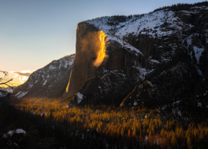
- January 21, 2026Yosemite Firefall 2026 GuideYosemite's natural firefall at Horsetail Fall draws hundreds of photographers for a few weeks in February when the setting sun lights Horsetail Fall and turns the water a brilliant molten orange, reminiscent of the Glacier Point firefall.Read More
- December 11, 2025Holiday Events in California: Yosemite Mariposa CountyThere’s no better way to cap off the end of the year than to get away to Yosemite Mariposa County for the holidays this year.Read More

- December 08, 2025Yosemite New Year’s Eve GuideReady for a New Year's celebration that you'll remember for a lifetime? Get out and greet a new year full of epic adventure in the epic landscape of Yosemite Mariposa County.Read More