When exploring the highways and byways of California, travelers must make a delightful choice — where to cross the state via four major highway routes to arrive in the Yosemite Mariposa County region such as the western approaches of Highway’s 41, 140 or 120, or to cross from the eastern approach via the beautiful Sierra Nevada mountain range. While Tioga Pass (Highway 120 East) is a worthy option as it cuts directly through the High Country of Yosemite National Park, the western approaches are equally impressive alternative routes to Yosemite Mariposa County where road-trippers can take their time and enjoy all that California and the mountains have to offer.
Note: If you’re planning to make the journey during the winter months, be sure you’re aware of Yosemite road conditions information when planning your trip.
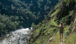
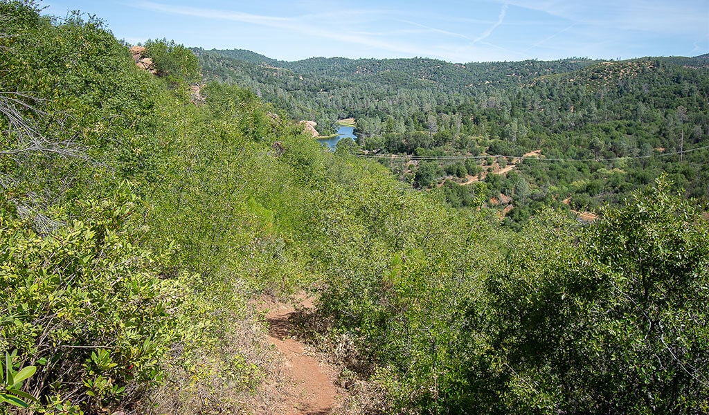
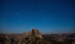
View From Above
For international and out-of-state visitors, or those navigating our state for the first time, the expanse of California can be a bit daunting. But California’s size is also its windfall, with an array of experiences that arise from a variety of landscapes be they mountain, ocean or desert.
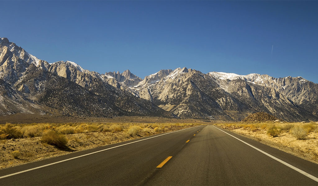
One of the most prominent of these geographic wonders is the Sierra Nevada mountain range. Running 400 miles (640 km) north-south down the eastern side of the state, the Sierra are a sight to behold with snow-capped peaks such as Mt. Whitney, the tallest peak in the contiguous United States (14,505 ft/4,421 m), countless azure lakes and wild, snowmellt-fed rivers.
This blissful divide creates distinct areas worth visiting — the steep, shadowy eastern Sierra (Highway 395), the deepwater mountain mecca of Lake Tahoe, and the steady, purposeful rise of the western Sierra which includes Gold Rush-rich Mariposa (Highway 49 & 140).
Sonora Pass (Highway 108)
Highway 108 links the ruggedly dramatic eastern side of the Sierras with the rolling majesty of history-rich Yosemite Mariposa on the western side while reaching its peak Sierra elevation at Sonora Pass. This route features sparkling vistas as it winds through a patchwork of pine and granite, providing access to an array of attractions such as tufa-dotted salt lakes, hot springs, hiking, and even ghost towns. Note: Sonora Pass closes in winter due to snowfall. This route has some of the steepest grades of any pass in California at 26% in a few places, but views are just as amazing as the road is steep, narrow and windy in places. This route is off-limits for RV’s and Campers. Check current road conditions here.
Option A: Spirits & Springs
This unique connection from the eastern Sierras to Mariposa via Sonora Pass covers a total of 170 miles (275 km) and requires 4 hours of drive time. Here are some worthy stops….
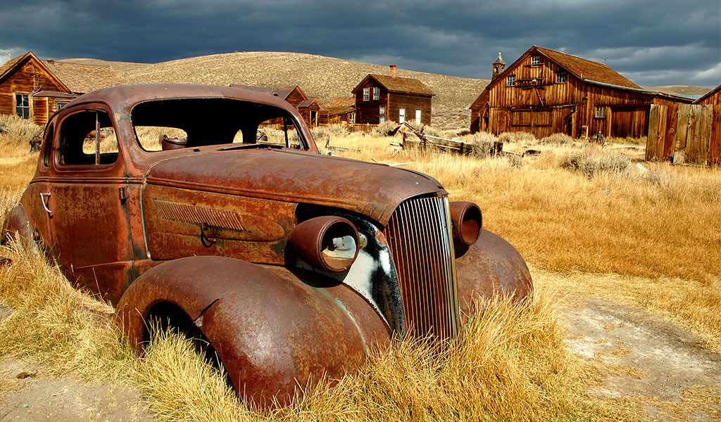
Gold & ghosts? Let’s bust this. Located in the high desert (8,375 ft/2,550 m) thirteen miles from Highway 395, Bodie became a boomtown in 1875 when a mine cave-in revealed the shiny stuff and 10,000 fortune-seekers soon followed. Once boasting 60 saloons, gunfights were common on the streets of Bodie providing much phantom-fodder for future generations. Fast forward to now and it’s a windswept ghost town (population zero) that’s preserved entirely in a state of “arrested decay.” Some might call it a living museum… perhaps a dead one is more on point.
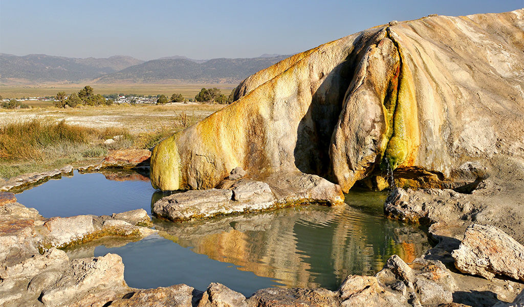
The Eastern Sierra is known for its thermal mineral springs. One of the more accessible is Travertine, located along Highway 395 just 8 miles (13 km) from the turnoff for Bodie. These bubbling beauts feature several terraced limestone terraces that gaze west towards prodigious Sierra peaks. The springs have long been a spiritual place for the native Paiute so please leave no trace and treat these natural wonders with the respect they deserve.
Turning onto Highway 108 from Highway 395 you begin the westward climb over the Sierras. This winding stretch feels remote, reinforced convincingly as you pass the sign for the Marine Corps’ Mountain Warfare Training Center (no public access) then rises steadily for another 34 miles (55 km) to the summit of Sonora Pass (9,624 ft/ 2,933 m). The road is steep, and the views spectacular. Fun fact: The Pacific Crest Trail crosses Sonora Pass at the 994-mile mark on its 2,653-mile journey northward from the border of Mexico to Canada.
Named after famed early California writers Mark Twain and Bret Harte, this cute little Sierra vacation town is set at 3,640 ft (1,110 m) and is a nice pit stop for walking the dog in Eproson Park, or linger longer to whack some balls at the Twain Harte Disc & Golf Club. With 9 holes of full-sized fun, traditional golfers can drive between the pines or yell Frisbee fore if discs are more your thing. Pint-sized golfers can practice their bank shots at Twain Harte Miniature Golf, one of the oldest putt-putt courses in the country operating for over 65 years.
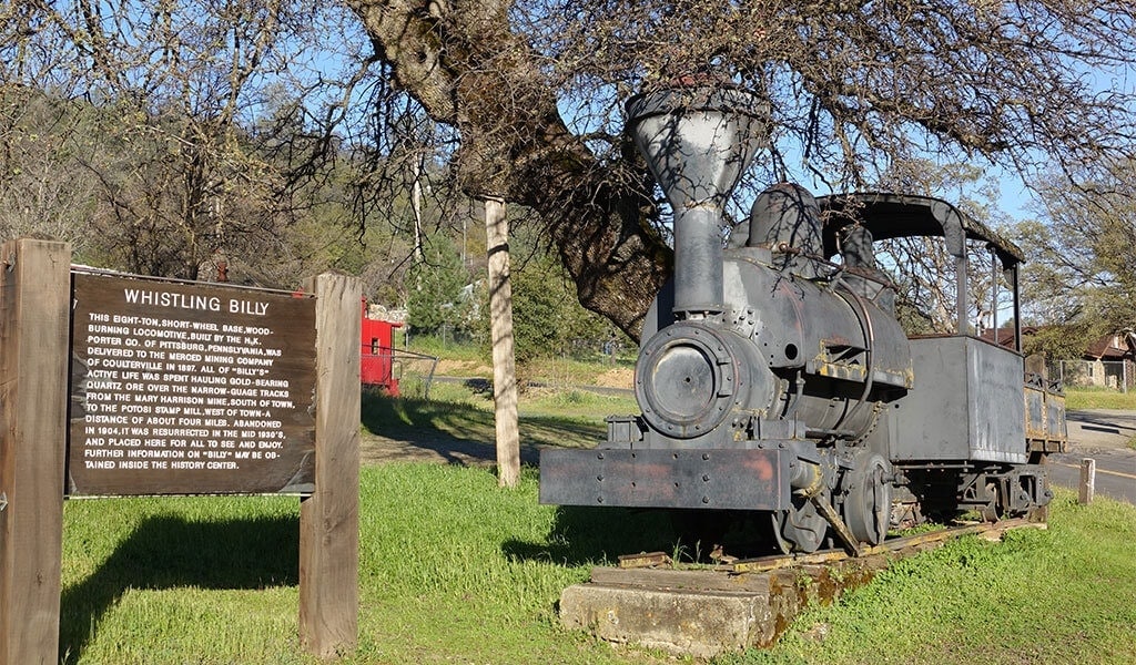
Leaving Highway 108 for the Gold Rush gauntlet of Highway 49, we come to Coulterville, the epitome of Old West charm. The entire town has been designated a California State Historical District, and here you can walk the main drag as though it were 175 years ago. Try the outdoor patio Coulter Cafe & General Store for some of the best grub around (and live music in summer!) or do a deep history dive at the Northern Mariposa County History Center.
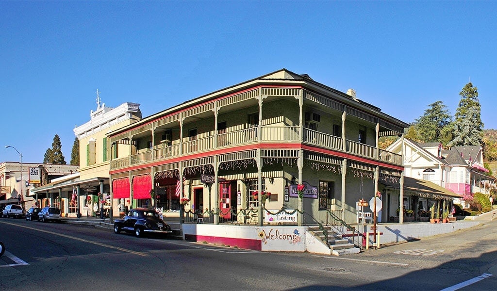
Situated along Highway 49, the town of Mariposa offers everything from deep Gold Rush history to foodie haunts, from shopping to wine & beer tasting all in one boots & Birks setting. As the hub of Mariposa County, this unique Sierra outpost is just 30 minutes from Yosemite National Park — the perfect staging area for your visit, not to mention a great place to spend the night.
Option B: Loops & Lakes
While still connecting the eastern Sierras to Mariposa via Highway 108, this route is all about lakes as it covers 200 miles (322 km) and requires just over 4 hours and 15 minutes of drive time.
This 16-mile loop road off of Highway 395 features a quartet of big and bigger Sierra snowmelt bowls — June Lake, Gull Lake, Silver Lake and the largest, Grant Lake. Commensurate with the ample surface area, water sports and fishing are the name of the game while hiking into the Inyo National Forest or the protected Ansel Adams Wilderness via the trailhead at Silver Lake provides landlubbers with some spectacular backcountry.
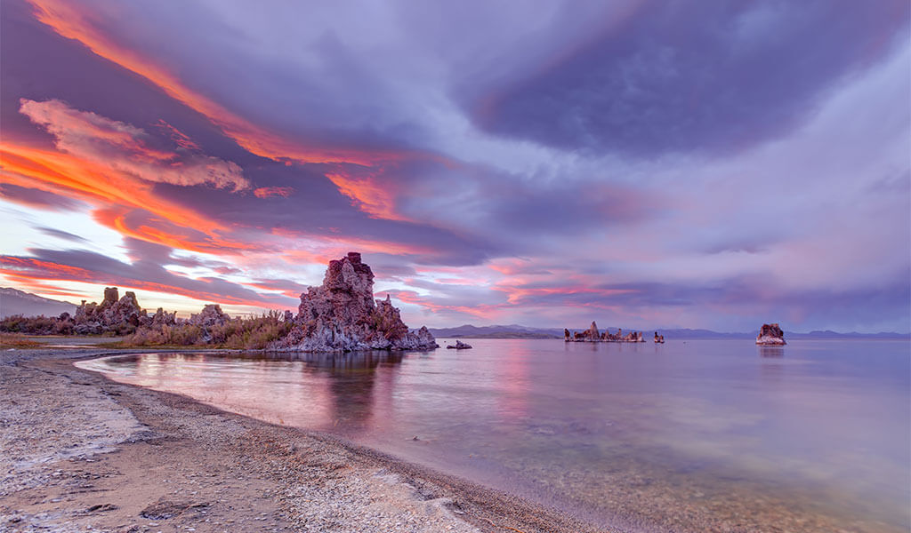
Mono Lake Tufa State Natural Reserve is unlike anywhere in the world. Rising from its 65 square miles of salty water are tufa towers — knobs of calcium-carbonate — creating a vast alien domain where birding (Mono Lake is a major habitat for millions of birds), photography and kayaking are just a few of the popular activities.
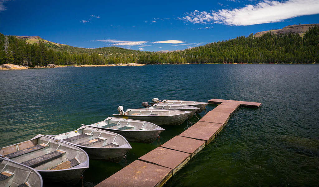
Nestled at 5,600 feet among the pines of the Stanislaus National Forest, Pinecrest Lake Resort offers rainbow trout fishing, a marina with boat rentals and a four-mile hiking trail that circles the lake. Summer brings an added bonus — Movies Under the Stars at the Pinecrest Outdoor Movie Theater — where families can enjoy silver-screen action while the Perseids blaze overhead (Memorial Day through Labor Day).
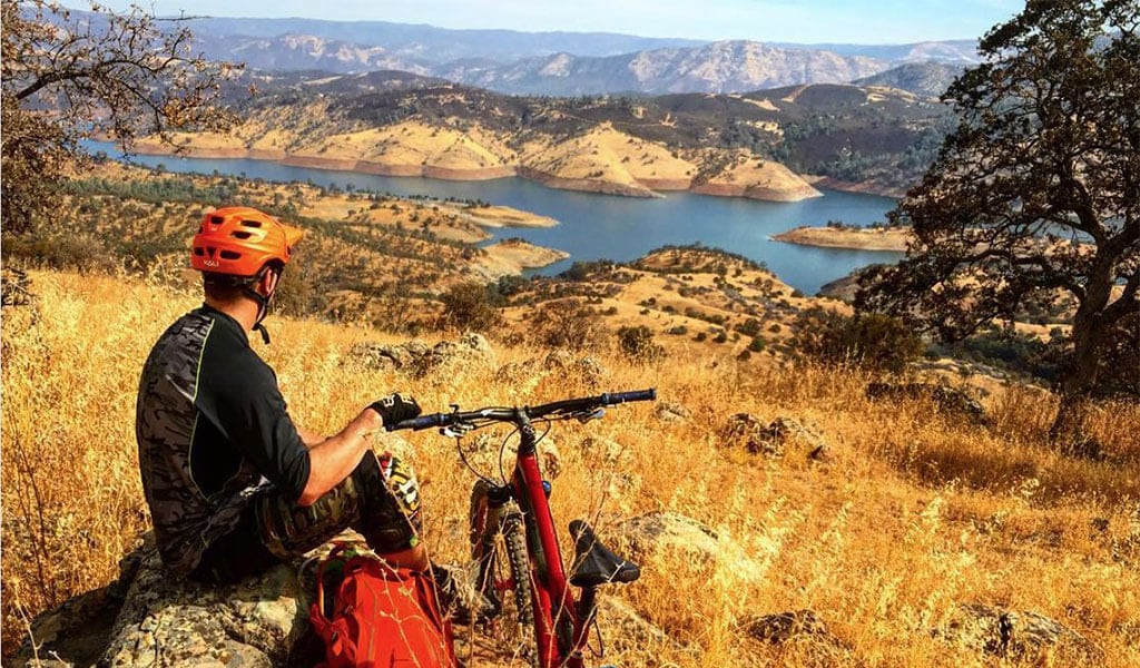
Situated at 867 feet (264 m) and fed by Yosemite’s Wild & Scenic Merced River, horseshoe-shaped Lake McClure features 80 miles of shoreline including three marinas, trophy-level fishing, family camping, water sports, house boating and mountain biking at Excheqeur Mountain Bike Park. Kids need a break from the car? Let them swim wild at Splash N Dash Aqua Park with its floating obstacle course and giant water slides.
As previously mentioned, the town of Mariposa has it all from rich history to restaurants and shopping all along the rustic sidewalks of its charming main drag. And a lake! Walk a few blocks from downtown to Stockton Creek Preserve to a series of trails around the shores of protected Stockton Creek Reservoir, featuring world-class birding as well as abundant amphibians and reptiles, including the Western Pond Turtle (the West Coast’s only native freshwater turtle).
Ebbetts Pass (Highway 4)
Ebbetts Pass (Highway 4) epitomizes the Sierra “backroad.” Weaving its way up and over the summit near the moody little postcard known as Lake Alpine, Ebbetts Pass connects the popular destination of Lake Tahoe with the gateway of Yosemite Mariposa and its abundance of things to do. This route covers a total of 180 miles (290 km) and requires four hours of drive time with each destination evenly spaced to minimize “when will we get there’s” from the kiddos. Note: Ebbetts Pass closes in winter due to snowfall. Check current road conditions here.
Ebbets Pass runs through the Carson-Iceberg Wilderness in the northern stretches of the Sierra Nevada range. Named for the Carson River, which bestows its name from American frontiersman, Kit Carson, the stretch of highway provides for beautiful views of pines and firs as well as “the Iceberg” a granite formation that the Wilderness takes the other half of its name from.
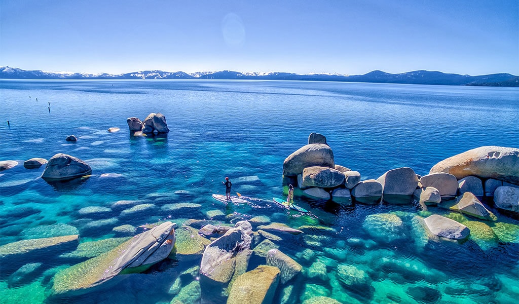
Lake Tahoe is a destination for visitors from around the globe, and deservedly so. Its blue waters and countless outdoor activities have inspired everything from the naming of trucks and camp gear to vodka and thousands of dogs. At 1,644 feet deep and 22 miles long, Tahoe is both big AND beautiful. Boating, swimming, fishing, beach-going and, yes, gambling, are all located in the shadow of Desolation Wilderness, where hikers can find unspoiled beauty astonishingly close to international cuisines and slot machines!
Getting from South Lake Tahoe to Markleeville requires a short and bucolic connection via Highway 89 as the golden splendor of Hope Valley stretches out below. Situated along the Carson River at 5,531 feet (1,686 m), the historic town of Markleeville is a great place to grab lunch or maybe take a soak at Grover Hot Springs State Park. The Alpine County Courthouse can be found on the main drag of this, California’s least-populated county. Not So Fun Fact: Jacob J. Marklee — founder of the town that was once a toll crossing for the booming silver mining industry — was killed in a gunfight here over a land dispute in 1863.
As a side note, if planning on connecting to Highway 395 from Markleeville, over the Monitor Pass, note the descending pass is a very narrow two lane road with an extremely steep grade, dropping over 3,300 feet in under 10 miles. RV’s and Campers are not advised on this section of travel.
Highway 4 begins about five miles beyond Markleeville as the road narrows (to a single lane in some spots, so take care while driving around blind turns) and climbs steadily towards Ebbetts Pass. At 8,730 feet ( 2,661 m), Ebbetts Pass was originally surveyed as a potential route for the Intercontinental Railway but that honor ended up going to Donner Pass to the north. Camping at Centerville Flat and Silver Creek can be found in this area, with the primary pursuit being a simple one — enjoying the surrounding beauty of the secluded pine forests along the Sierra’s least-used mountain pass.
The granite basin and vivid blue waters of Lake Alpine make the rolling white summer clouds jump to life at this beautiful Sierra resort. Set at 7,300 feet (2,225 m), Lake Alpine offers a boat launch, fishing, swimming, camping (6 campgrounds surround the lake) and picnicking at the Lake Alpine and Chickaree Day-Use Areas. Feel like stretching your legs? A four-mile loop trail around the lake begins at the Pine Marten Campground with a wonderful option of climbing the .8-mile spur trail to Inspiration Point (600 foot elevation gain) for a spirit-boosting aerial view of happy campers below.
With spice shops, wineries and art galleries, not to mention Gold Rush-era elevated sidewalks to match its elevated foodie fare, Murphys has become a hot spot for weekenders in recent years. Set at 2,172 feet (662 m) along Highway 4, Murphys epitomizes old-meets-new by hosting nationally-touring bands at its Ironstone Winery Amphitheater while its historic Murphys Hotel has hosted such guests as Mark Twain and Ulysses S. Grant. Why were the sidewalks elevated, you ask? To make climbing into and out of stagecoaches an easier endeavor! Infrastructure, indeed.
If the above description of Gold Rush nugget Coulterville weren’t tempting enough, how about taking some IG shots in front of the historic (and haunted!) Hotel Jeffery where President Teddy Roosevelt once stayed (currently closed for tours) or stop by the adobe-walled Sun Sun Wo General Store — the last remnant of the Mother Lode’s largest Chinatown.
Ah, yes, back to our beloved historic hub and gateway to the wonders of Yosemite National Park. From work/learn stays to weekend getaways and as an essential stopover for international travels, come to Mariposa County and build an itinerary that suits your sense of curiosity and adventure.
- July 16, 2026Tips to A Great Yosemite Summer VisitPlan your Yosemite summer getaway with tips on exploring Hetch Hetchy, Yosemite Valley, Tioga Road, and relaxing by the Merced River.Catch these must-know tips to make the most of your time in Yosemite.Read More
- July 14, 2026How to Watch the Perseid Meteor Shower in Yosemite Mariposa CountyWish upon a shooting star during the Perseid Meteor Shower in Yosemite Mariposa County. The dark night skies in this area create exceptional night-sky viewing. So, read up for more information on where to go and what to bring with you this year.Read More
- May 14, 2026100 Things To Do In Mariposa County | Outside YosemiteDiscover 100 things to do in Mariposa County beyond Yosemite National Park, from outdoor adventures and historic Gold Rush towns to local food, lakes, art, and hidden gems throughout the Sierra foothills.Read More