DJs young and old know the double-sided design of vinyl records naturally leads to the nomenclature of “A-side” and “B-side.” The A-side is traditionally the “hit,” the popular song that everyone loves while the undiscovered, alternative gem is often found on the “B-side.” The B-side can reveal something surprising and new ““ and even rival the popularity of the A-side with soul-stirring arrangements of its own.
Yosemite National Park offers chart-topping A-sides: Half Dome, El Capitan, Yosemite Falls, etc. Places you know by heart, at the top of every “must-see” list. On the flip side, Yosemite Mariposa County’s B-side destinations deliver titanic geology, thundering waterfalls, and fabulous superflora. Give these hidden tracks a spin and expand your Yosemite collection!
Note: for those of you born in the CD era or later, “B-sides” relate to the records or cassette tape era of music when you literally had to flip the disc to hear more songs. “B-sides” were considered less popular or lesser known, but there are some classics on the B-side such as Creedence Clearwater Revival’s “Born on the Bayou” and Dionne Warwick’s “Always Something There to Remind Me”.
North Dome
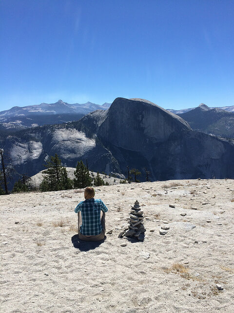
Sentinel Dome earns every note of its A-side status for a valley full of panoramic views, but here’s a gem directly across Yosemite Valley that’s classic B-side: North Dome. Talk about unsung: there’s barely a mention of this Tioga Road treasure on the national park website. The all-day hike from Porcupine Creek Trailhead to the north rim of Yosemite Valley delivers unrivaled views of Half Dome, just a few hundred yards away as the hawk soars. On the other side of North Dome from its halved sibling are unrivaled views looking down Yosemite Valley over Ahwahnee Meadow and Yosemite Village.
Hetch Hetchy Waterfalls
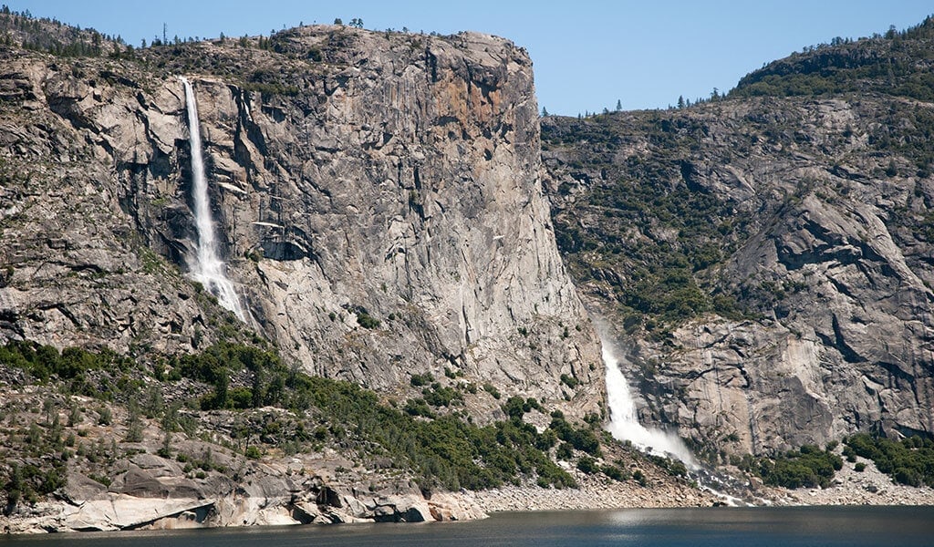
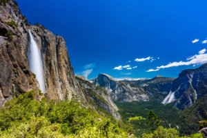
Yosemite Valley’s waterfalls are operatic, but the B-side score is just as dramatic at Hetch Hetchy, truly one of Yosemite National Park’s underappreciated players. Tucked into the Park’s peaceful northwest corner with its own entrance, Hetch Hetchy Valley has soaring peaks, steep canyons, and torrential waterfalls, too. O’Shaughnessy Dam, at the west end of the valley, provides a panorama of the reservoir and wilderness beyond, including 1,000-foot-plus Wapama Fall. The 5.5-mile round-trip hike is one of Yosemite’s biggest bangs-for-the-boots.
Giant Sequoia Grooves
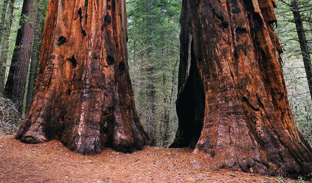
The Mariposa Grove of Giant Sequoias is a fan fave as the largest collection of Sequoiadendron giganteum in Yosemite National Park. It’s so A-side there’s even a visitor center here. Ready to branch out to the B-side? Tune in to Highway 120 for a pair of equally impressive giant sequoia stands. Merced Grove is the smallest… ah, most compact … giant sequoia grove in Yosemite with around 20 mature trees. And it’s not going out on a limb to say this may be the quietest grove in Yosemite with a cathedral-like grace. Just a few miles east of Merced Grove on Highway 120, Tuolumne Grove hosts about two dozen giant sequoias rising from the gorgeous Pacific dogwood understory. The Tuolumne Grove trail is also a popular venue for cross-country skiing and snowshoeing. Mariposa Grove has its own B-side as well… the upper grove of giant sequoias. This upper grove takes a bit more stamina to hike to, accomplished by hiking the 6.5-mile Guardians Loop trail, but huge rewards ““ pun intended! The upper grove is home to the largest and oldest trees Mariposa Grove has to offer.
Artist Point
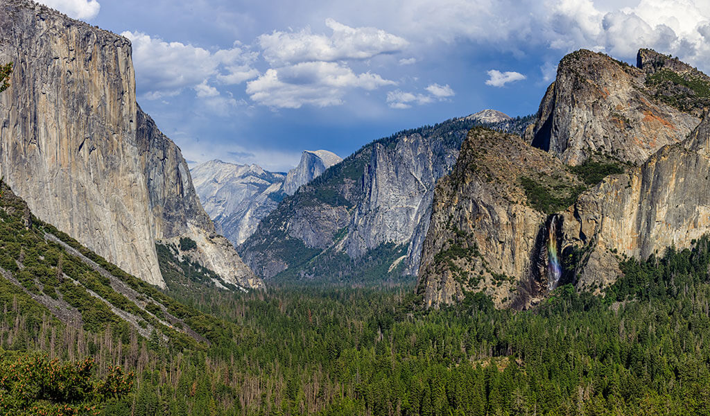
How appropriate that Artist Point is one of Yosemite’s best B-sides. This hidden roost is an easy two-mile hike from one of the most visited turnouts in the entire park: Tunnel View. Many say the view from Artist Point is even superior to Tunnel View, and the photo potential is greatest hits material! Park in Tunnel View’s lot and proceed to the trailhead on the uphill side of the road. In a mile, you’ll reach Artist Point where fancy cameras and easels are often part of the lookout’s inspired creative scene.
Hiking El Capitan
El Capitan is one of most heralded monoliths in the West, with most visitors admiring its grand granite visage from a distance. Flip the disc for the B-side: hiking El Capitan. Tough but rewarding, the El Capitan Trail is double-album length at 15 miles with a 4,800-ft. elevation gain ““ but oh, the views: Taft Point, Dewey Point, Clouds Rest and North Dome, just for starters. Find the El Cap trailhead between the Yosemite Lodge and Camp 4. Extended play: take the spur trails to the top of Upper Yosemite Falls on the way there or back.
Note: Getting to the top of Yosemite Falls is no walk in the park. It’s a climb in which you’ll need to bring plenty of water and sunscreen. Look at our Nature Rules page to learn how to be safely prepped for a trip to Yosemite Mariposa County.
Mariposa County
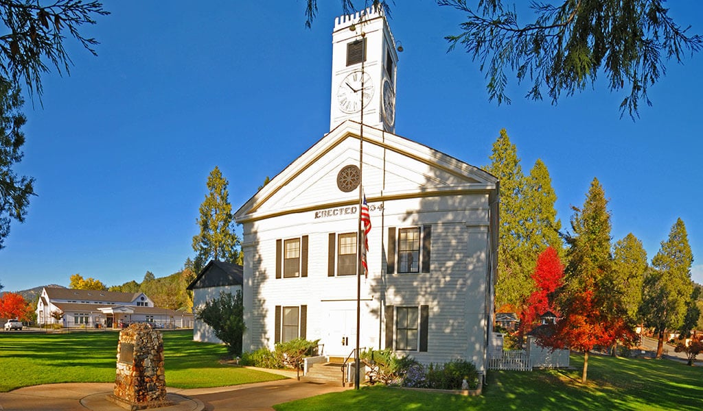
Staying deep in the groove: if Yosemite Valley is like a stadium show for the hottest band in the land, then old town Mariposa County is that cool club where the musicians gather to revel and riff! Exit the park VIA highways 140, 120 and 41 to find yourself in an authentic historic wonderland. Mariposa County is your go-to for great places to stay, local shopping and dining, and Gold Rush history along every sidewalk and side street. Hub of the region and county seat, Mariposa hits all the right notes with year-round festivals, libations, and a vacation vault of authentic landmarks and legends. Branch out from Mariposa for hiking and outdoor activities in the Sierra and Stanislaus National Forests as well as Bureau of Land Management areas along the Wild and Scenic Merced River Canyon.
Chilnualna Falls
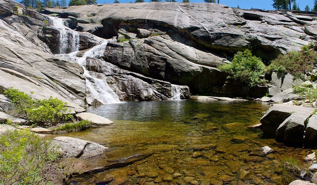
Yosemite Valley is stacked with world-class waterfall hikes including the Mist Trail and Yosemite Falls. Ready for a B-side with booming, year-round flow? Check out Chilnualna Falls in Wawona. The strenuous 8-mile trail, which can be remixed to suit your interest and physical fitness, begins at an elevation of 4,200 feet and plays hide-and-seek with a series of falls, cascades and cataracts. Discover the trailhead just off the Chilnualna Falls parking area, two miles up from Chilnualna Falls Road located in another classic B-side hamlet, historic Wawona.
Olmsted Point
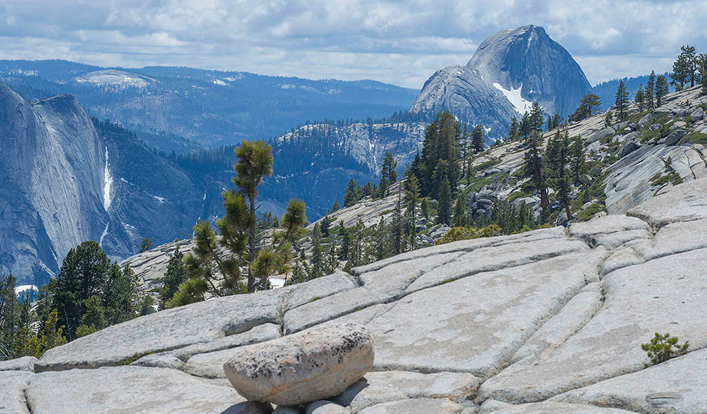
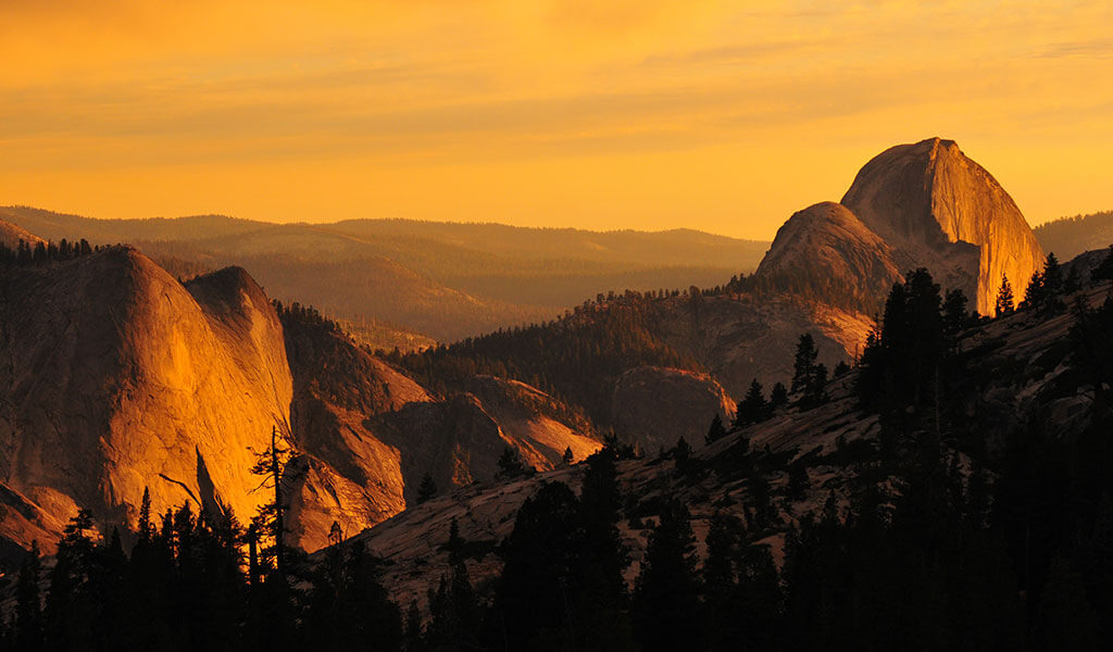
The vista point at Glacier Point is dripping with A-side star power, but vehicle access to this panoramic peak is closed until 2023 due to road construction. In other words ““ it’s the perfect time to head over to the B-side of Northern Yosemite, where Olmsted Point is one of the best places to see this glaciated granite wonderland. Located right off Tioga Road (one of the most scenic byways of the American West), Olmsted Point offers up Ansel Adams’ vistas of Clouds Rest, Half Dome, and the glittering sapphire jewel of Tenaya Lake. Tioga Road is typically open for vehicles by late May/early June before closing in October/November for the winter.
To explore lodging options, things to do and places to eat, visit Yosemite.com, the #1 trip planning site for vacations to Yosemite National Park and historic Mariposa County. To stay up to date, follow @YosemiteNation on social media and subscribe to our newsletter, “The Wanderer”. Be sure to subscribe to our YouTube channel for great videos on the people and places of Yosemite Mariposa County.

