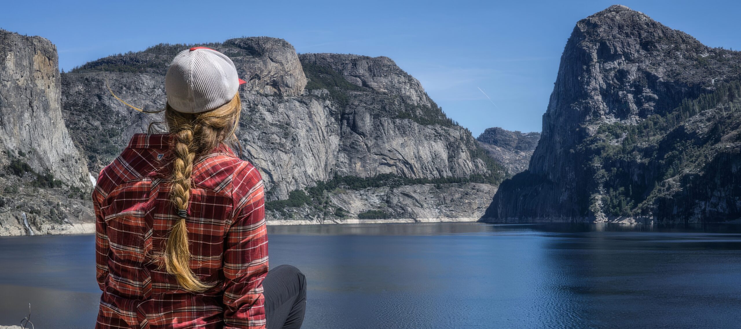
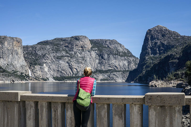
Rounding the corner and catching the first glimpses of Hetch Hetchy Valley reveals the play of light on water. In the distance, long white plumes of water cascade hundreds of feet down from rocky heights. The falls roar in spring and early summer. In the foreground, the deep still water of Hetch Hetchy Reservoir reflects sunshine, clouds and the proud shadows of the surrounding mountains. John Muir once described Hetch Hetchy Valley as, “a grand landscape garden, one of Nature’s rarest and most precious mountain temples.”
Even in the summer when Yosemite Valley is being explored by visitors from around the world, Hetch Hetchy remains an oasis of relative calm. Only a tiny proportion of Yosemite’s visitors explore this out-of-the-way corner of the national park.
There is no Starbucks here – no daily parade of tour buses and RVs. Instead, the magnificence of a valley often described as Yosemite Valley’s slightly smaller twin takes center stage. If you delight in getting off the well-beaten path, or if you are looking for a peaceful natural retreat, it’s perfection.
Getting to Hetch Hetchy
Although Hetch Hetchy is included within the boundaries of Yosemite National Park, the entrance is separate from the rest of the park. To get to Hetch Hetchy, turn north off Highway 120 onto Evergreen Road about 1 mile (2.2 km) outside the Big Oak Flat Entrance gate, and 12.5 miles (20 km) east of the small community of Buck Meadows. From the turn-off, the road winds for 16.5 miles up the old Hetch Hetchy railroad grade (26.5 km) to the Hetch Hetchy Reservoir, passing many lonely trails along the way.
If you’re up for a driving adventure, try taking a little extra time to retrace parts of the route John Muir described in his book, “My First Summer in the Sierra”. His path roughly follows the John Muir Highway – State Highway 132 that runs from Highway 49 in Coulterville up through Greeley Hill before connecting back into Highway 120 before Buck Meadows and the turn-off to Hetch Hetchy. While you’re at it, plan to add to the historic flavor of this route with a stop the Northern Mariposa County History Center.
Hetch Hetchy Geology
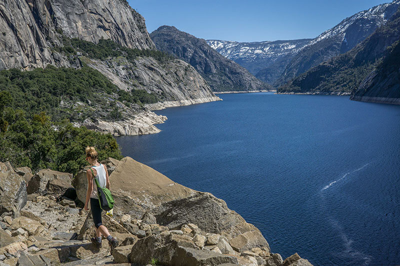
Hetch Hetchy and Yosemite Valley are so similar because they were created by the same sequences of geological activity. They were both initially carved by rivers flowing down the Sierra’s relatively gentle western slope. Glaciers followed these low-points, leaving their own marks – in particular carving out the characteristic U-shaped valley with steep sides and wide floor. Once the glaciers retreated, tributaries leading into the main river were left hanging hundreds or thousands of feet above the valley floor, creating the beautiful waterfalls we know today.
The Hetch Hetchy Reservoir
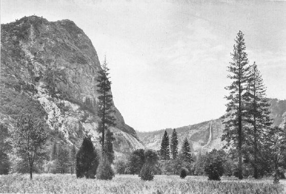
For all the similarities between Hetch Hetchy Valley and Yosemite Valley, there is one enormous difference – the Hetch Hetchy reservoir.
The surface of the water hides an additional 300 feet of granite cliffs and once-upon-a-time waterfalls within its depths. When you’re standing at the shore overlooking what appears to be a lake, picture yourself looking down into a verdant valley filled with the tall native grasses that give the valley its name.
At full capacity, the reservoir stretches eight miles (13 km) upstream of the O’Shaughnessy Dam. The water winds between granite features like Kolana Rock and Hetch Hetchy Dome.
The reservoir supplies water for the city of San Francisco, so there is no recreational boating or swimming allowed. And, as you might imagine, it produces some of the cleanest municipal water in the United States. As of 2013, the water storage and hydroelectric power supplied by the Hetch Hetchy Project serviced an estimated 2.6 million people in the San Francisco Bay Area.
Building the Hetch Hetchy Dam
But how did the dam get to be here? Could you imagine building a dam inside a national park today?
The same features that make Hetch Hetchy Valley so spectacular also make it an ideal location for a dam. The glacially-carved U-shaped valley floor maximizes the amount of water stored in the reservoir. Plus, the granite walls converge into a narrow outlet at the bottom of the valley – the perfect location for a dam.
San Francisco had its eyes on this water source early on and repeatedly tried to acquire water rights to the Tuolumne River. But Hetch Hetchy was a federally protected as part of Yosemite National Park. Building a dam there was off the table.
Then, in 1906, a devastating earthquake caused a series of fires in San Francisco that destroyed 25,000 buildings across 490 city blocks. The inadequacy of the city’s existing water supply came into sharp focus. San Francisco applied once again for rights to Hetch Hetchy in 1908.
Of course, the proposal was immediately opposed by environmentalists including the Sierra Club and John Muir. As Muir famously protested: “Dam Hetch Hetchy? As well dam for water-tanks the people’s cathedrals and churches, for no holier temple has ever been consecrated by the heart of man.”
In spite of Muir’s eloquent and heated objections, the Raker Act was signed into law in December of 1913. San Francisco could flood the valley and work began the following year.
The Building of the O’Shaughnessy Dam
Building the Hetch Hetchy dam in such a remote location was an enormous project. Before they could break ground at the O’Shaughnessy Dam, more infrastructure was required. To get the electricity they would need, they first built a smaller dam at Lake Eleanor. Plus, they needed a way to bring supplies and workers into the mountains.
The construction of the Hetch Hetchy Railroad took place from 1915 to 1918. The new 68-mile (109 km) railroad wound its way up the narrow canyon of the Tuolumne River past sharp curves and up steep 4% grades. It carried workers and materials for the dam, as well as tourists, postage and other amenities. If you want to follow the old railroad line today, the Hetch Hetchy Road and most of the Mather Road were built on the old railroad bed and are beautiful scenic drives as well.
Finally, with the railroad complete, teams broke ground on the O’Shaughnessy Dam on August 1, 1919. They poured an estimated total of more than 398,000 cubic yards (304,000 cubic meters) of concrete to form the dam. It was the second tallest dam in the U.S. at the time.
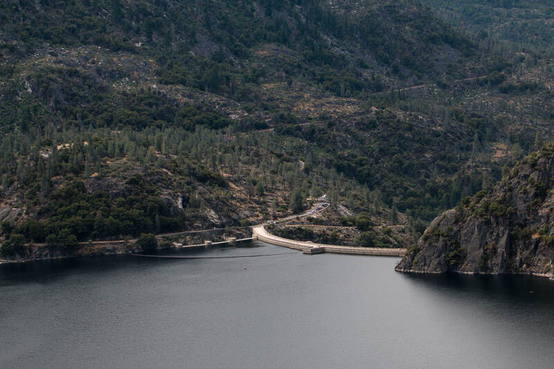
Teams completed the O’Shaughnessy Dam in 1923 and the reservoir filled for the first time in May of that year. Including additions made between 1934 and 1938, the dam currently stands 430 feet (131 m) above the bedrock below. It spans 900 feet (270 m) with a 17-foot (5.2 m) wide trail across the top that hikers use to cross to the opposite side.
Ongoing Controversy About Restoring Hetch Hetchy
Controversy continues to swirl around the Hetch Hetchy Dam even now. There have been lawsuits over whether San Francisco violated the agreements of the Raker Act. The National Park Service conducted research to determine what would happen if the dam were removed, and people have repeatedly proposed costly studies to further understand the consequences of removing the dam. In 2019, Restore Hetch Hetchy commissioned another study that found enormous ‘recreational value’ from removing the dam. They suggest that draining the reservoir and turning Hetch Hetchy Valley into a tourist center similar to Yosemite Valley could be worth up to $178 million per year. Would that be an improvement?
Hiking in Hetch Hetchy
While the debate goes on, Hetch Hetchy remains a relaxing and often-overlooked corner of the park – much to the delight of hikers and backpackers who prefer less touristy experiences.
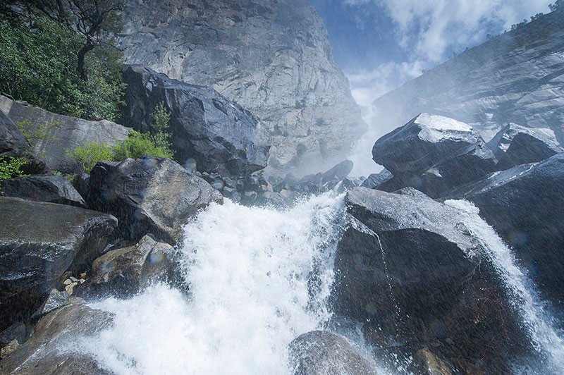
Although there are relatively few visitors to Hetch Hetchy, you’ll find most of them along the trail to Wapama Fall. Start by hiking across the O’Shaughnessy Dam then turn east along the shore of the reservoir. The gently rolling terrain has excellent views of the water and eye-catching Kolana Rock, which towers roughly 2,000 feet above.
After 2.5 miles (4.0 km), you’ll reach the Wapama Falls Bridge with an up-close view of the lowest section of Wapama Falls. For most of the year the waterfall offers a refreshing shower or cooling mist along with an amazing view. But during peak spring flow, the thundering waterfall can wash over the bridge making it dangerous to cross. People have died after being swept off the bridge and onto the rocks below. Use good judgment and stay safe.
Most people turn around here anyway. But if you still have energy, continue past the bridge to Rancheria Falls. As a 13.4-mile (21.4 km) round-trip hike, Rancheria Falls gets fewer day-hikers than Wapama Falls but is a popular backpacking stop. Rancheria Falls itself is a series of whitewater cascades that crashes through a narrow canyon on its way to the reservoir. There are many places to stop and enjoy views of the rushing water before turning around to return to your car.
Laurel Lake and Lake Vernon
Another popular trail crosses the O’Shaughnessy Dam and then takes a left turn to climb steeply out of the Hetch Hetchy valley. Each switchback reveals scenic overlooks of the reservoir and Kolana Rock. The trail continues to climb for 1.8 miles (2.8 km) above the trail intersection, but you can turn around any time.
If you’re excited about a long hike or backpacking trip, you can continue to Laurel Lake for a 14.2-mile (22.9 km) out and back. Other trails also continue to Lake Vernon. That trip is a 19.1-mile (22.9 km) out and back, or you can turn the hike into a loop that returns past Rancheria Falls (28.2 miles, 45.4 km).
Traveler’s Tip: Buck Meadows on the Way to Hetch Hetchy
If you love that insider feeling of discovering an often-overlooked gem, plan a stop at Buck Meadows on your way to or from Hetch Hetchy. Coming from the San Francisco Bay Area you’ll pass right through Buck Meadows on Highway 120. It is 13 miles from the Yosemite National Park border and twice as close to the park than the town of Groveland. You could miss this small mountain community if you blink at the wrong time, but it is home to a few remarkable small businesses.
For example, plan to stop at the Lucky Buck Cafe on your way to or from a day of exploring Yosemite. Formerly called Buck Meadows Restaurant and Bar, the new café crosses rustic-mountain flair with roadside cafe friendliness. Expect delicious meals and hearty portions to fuel your adventure or beat that post-hiking hunger.
Buck Meadows is also a great place to spend the night.
Right next to the Lucky Buck Cafe, you’ll find the Yosemite Westgate Lodge and Buck Meadows Lodge. Yosemite Westgate Lodge offers newly-remodeled and well-appointed modern accommodation. The spacious rooms include access to a heated swimming pool, spa, playground, and laundry facilities.
Not far from there, you’ll find more budget-minded lodging at Buck Meadows Lodge. These clean and comfortable rooms also enjoy access to the pool, spa and other facilities at Yosemite Westgate Lodge.
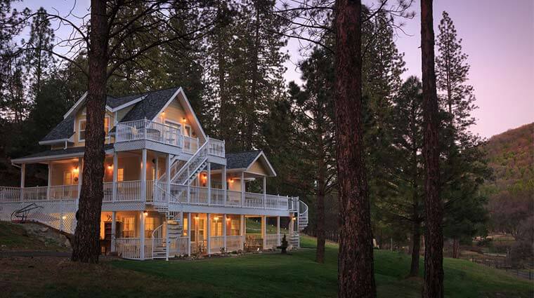
If you’re especially in the mood to relax and let yourself be taken care of, The Blackberry Inn is a luxury bed and breakfast situated on 36 acres and surrounded by National Forest land. Five country-chic rooms in the main building include en suite bathrooms, free WiFi and electric fireplaces. A full breakfast is served in the dining room. An adjacent building contains another five suites with vaulted ceilings, forest views and soaking tubs. Guests at these suites receive breakfast on their patios. Enjoy elegant touches like wrap-around porches, and fresh-baked cookies served daily.

