Public Transportation
Using public transit to get to Yosemite can be an affordable, sustainable, and more relaxing way to see the area. There are several Yosemite transportation options for the visitor relying on public transit. You can fully utilize public transit options for coming to Yosemite from any major city in California, year round!
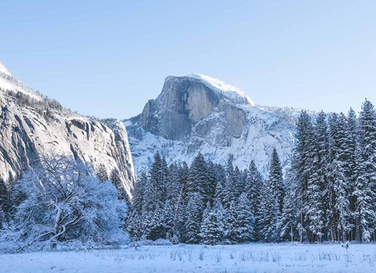
If you are coming in winter, chances are the roads will be clear depending on which highway you are traveling on. There four entrances to Yosemite. Tioga Pass or Hwy 120E is generally closed October-May, all other entrances remain open. View our Road Conditions page for more information on gateways to Yosemite and winter travel.
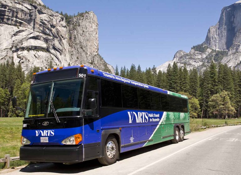
The Yosemite Area Regional Transportation System (YARTS) has been operating in the Yosemite region since 2000 and has provided an alternative to driving to over one million riders during that time.
YARTS is safe, comfortable, economical and convenient.
During the winter, YARTS is the easiest way to access the park along State Highway 140 from your hotel without having to worry about taking tire chains. In the summer, YARTS provides an alternative to wasting time looking for parking. We recommend leaving your car at your hotel or one of the many free and secure parking lots in Mariposa or El Portal.
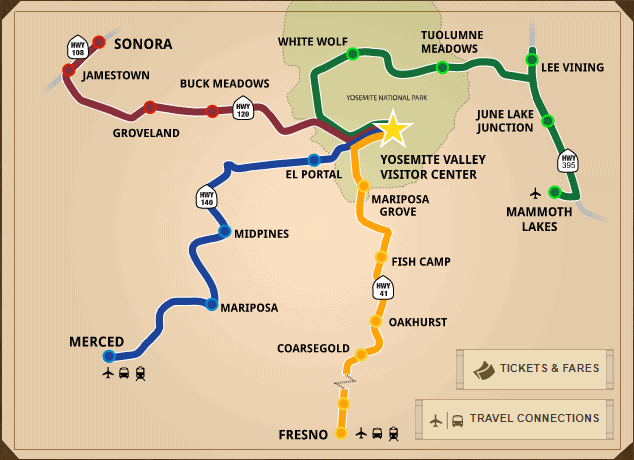
Your entrance fee is also included, so this Yosemite transportation option is green in more ways than one! Year-round the State Highway 140 route has connections to Amtrak and Greyhound so you can easily travel to Yosemite using public transit from most major cities in California. YARTS also runs along State Highway 41 in the summer months starting in Oakhurst as well.
YARTS provides:
- Regularly scheduled, fixed route public transit service into Yosemite National Park from gateway communities
- Year round service on State Highway 140 from Merced to Yosemite, through Mariposa County
- Summer service from Mammoth Lakes and other Mono County destinations
- Summer service from Sonora and other Tuolumne County destination
- Summer service on State Highway 41 from Oakhurst to Yosemite.
In Yosemite, YARTS makes connections with the Valley Shuttle and Tuolumne Meadows (summer only) shuttles (both free).
State Highway 140 YARTS
Learn more at www.yarts.com or call 1-877-989-2787.
For tours from San Francisco or within Yosemite National Park, please see our Tours page.
YOSEMITE VALLEY FREE SHUTTLE
One of the best services to take advantage of during your trip to Yosemite is the free shuttle bus. Parking (especially in the busy summer months) can be difficult and it’s best to park your car and take the shuttle where ever you need to go around the Valley Floor. Plan your route by viewing the shuttle map.
Best of all, the shuttle is free!
AMTRAK Trains
Amtrak trains have service all throughout California and can connect you to Yosemite from most major cities. You can book your trip to Yosemite from the Amtrak website and connect to the YARTS bus from the Amtrak station in Merced from both northern and southern California destinations. The YARTS bus continues down State Highway 140 and has convenient stops at several hotels in Mariposa, Midpines, and El Portal, as well as stops at Yosemite Valley lodging.
From San Francisco, eco-friendly transportation by AMTRAK train and YARTS bus can be arranged by California Pacific Excursions if you have booked your own hotel rooms in Mariposa, El Portal, or Yosemite Valley.
Learn more at California Pacific Excursions or call 1-415-228-9865.
Closest Airports to Yosemite
Private charter planes can fly into an airport just a few miles from downtown Mariposa at the Mariposa / Yosemite Airport (KMPI).
For commercial flights, the closest airports to Yosemite Valley are Fresno Yosemite International Airport (FAT) and the Merced Regional Airport (MCE). Merced Regional Airport is the closest to Yosemite Valley and has very affordable rates but it only caters to those flying to or from Los Angeles International Airport (LAX) and Oakland International Airport (OAK). The Mammoth Yosemite Airport has access to Yosemite via the Tioga Pass Entrance between June – October when Tioga Pass is open.
If flying into Fresno Yosemite International Airport, you can rent a car or take the YARTS bus from Merced to the closest lodging to Yosemite in Mariposa, Midpines, El Portal and Yosemite Valley along State Highway 140. You can rent a car or take the YARTS bus from Fresno to lodging in Fishcamp, Wawona and Yosemite Valley along State Highway 41.
Many travelers choose to fly in at SFO, San Jose, Oakland or Sacramento due to a greater variety of flight options and cheaper prices. From these northern California airports it is roughly a 3.5 to 4 hour drive.
From major Bay Area airports, the closest driving route is along State Highway 140 and the nearest lodging to the park is located in Mariposa, Midpines, and El Portal. From the Bay Area you can fully take public transit, here is article on how to get to Yosemite from BART.
Travel Time and Distances
Yosemite Valley Distances from Major Airports
Merced Regional Airport
83 Miles
133 Kilometers
1.59 hrs Travel Time
Fresno Yosemite International Airport
94 Miles
151 Kilometers
2.24 hrs Travel Time
San Francisco International Airport
200 Miles
321 Kilometers
3.31 hrs Travel Time
Los Angeles International Airport
300 Miles
482 Kilometers
5.25 hrs Travel Time
Distances to Town of Mariposa
El Portal
30 Miles
48 Kilometers
.67 hrs Travel Time
Yosemite Valley
36 Miles
57 Kilometers
.50 hrs Travel Time
Coulterville
28 Miles
45 Kilometers
.75 hrs Travel Time
Buck Meadows
46 Miles
74 Kilometers
1.25 hrs Travel Time
Sonora
57 Miles
92 Kilometers
1.5 hrs Travel Time
Oakhurst
28 Miles
45 Kilometers
.75 hrs Travel Time
Fish Camp
46 Miles
74 Kilometers
1.25 hrs Travel Time
Wawona
60 Miles
97 Kilometers
1.5 hrs Travel Time
Fresno
72 Miles
116 Kilometers
1.5 hrs Travel Time
Sacramento
156 Miles
251 Kilometers
2.5 hrs Travel Time
San Francisco
166 Miles
267 Kilometers
4 hrs Travel Time
Monterey
155 Miles
245 Kilometers
4 hrs Travel Time
Tahoe
205 Miles
288 Kilometers
4 hrs Travel Time
Los Angeles
292 Miles
470 Kilometers
7 hrs Travel Time
Eureka
431 Miles
694 Kilometers
8 hrs Travel Time
Las Vegas
467 Miles
752 Kilometers
8 hrs Travel Time
New York
2817 Miles
4656 Kilometers
47.15 hrs Travel Time
Tokyo
5312 Miles
8549 Kilometers
Berlin
6827 Miles
10987 Kilometers

