
Yosemite National Park is a UNESCO World Heritage Site, celebrated for its massive, evergreen-studded granite terrain. There are enough domes, walls, spires, bowls, and cliffs in Yosemite to wow everyone from geology department post-docs to the rest of us who just love big rocks.
Powerful geologic forces shaped this landscape, including glaciation, erosion, rockfalls, and earthquakes. Since Yosemite Mariposa County is made for geo-tripping, we’ve assembled a topline list of Yosemite’s greatest rocks and where to find them.
How was Yosemite Valley Formed?

Dynamic tectonic episodes created Yosemite’s panorama of granite, metamorphic and volcanic bedrock. There are at least 16 types of granite, including El Capitan granite, Bridalveil granite, and Half Dome granite, found across the Park.
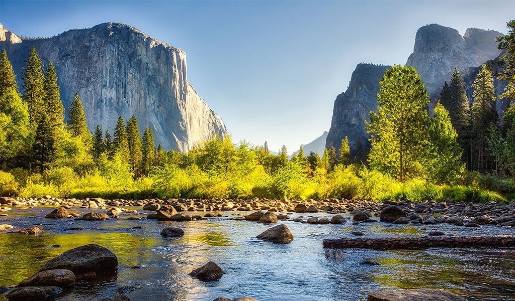
Yosemite Valley is one of the most famous topographic features on the planet – how was all that granite pushed around and molded to shape the Valley? A river-carved canyon has existed here for tens of millions of years. Seismic waves of mountain uplift around five million years ago caused the Merced River to steepen and cut the canyon deeper. As the climate supercooled, Ice Age glaciers arrived about 2.5 million years ago to sculpt the Valley’s classic outlines.
Ice alone couldn’t carve this masterpiece; it needed some help from cracks and fissures already present. The rock-solid truth: the interaction of glaciers with underlying rock, specifically the vertical joints in the Valley’s bedrock, resulted in the masterpiece of geology we call Yosemite Valley.
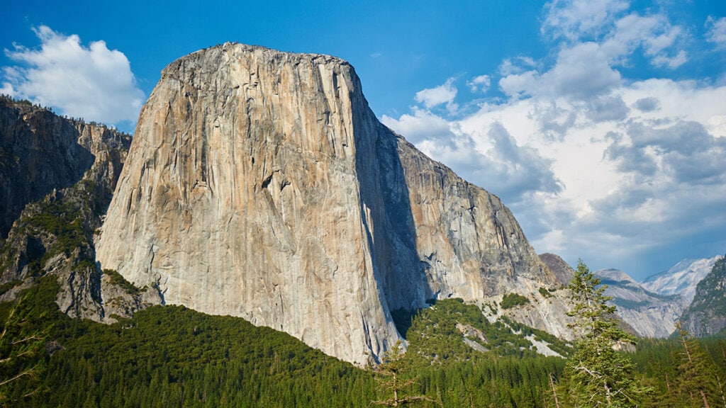
El Capitan
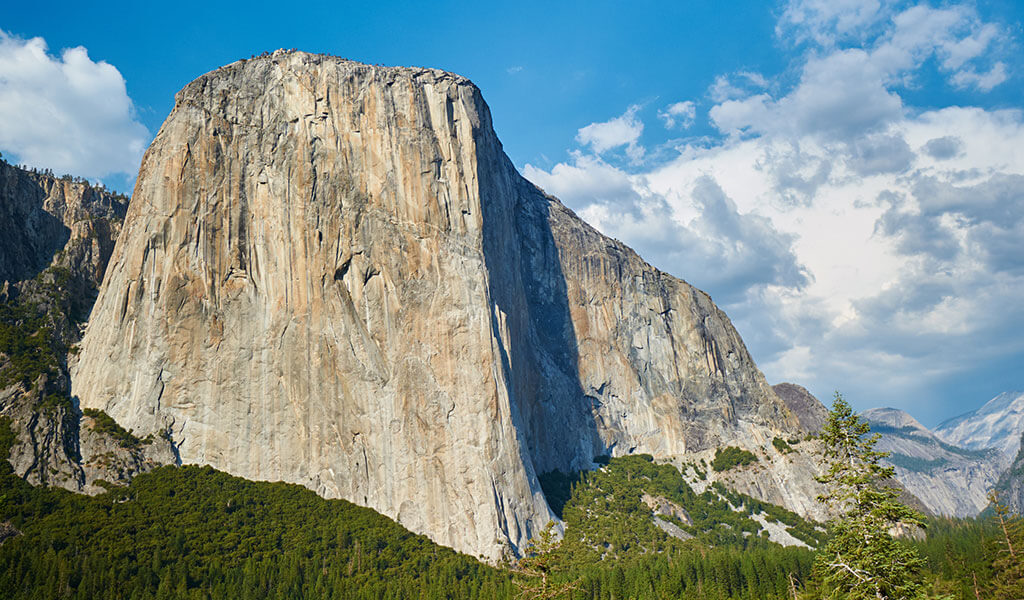
Soaring over 3,000 feet above the floor of Yosemite Valley, the massive face of El Capitan is one of the Park’s most prominent features. For a sense of scale, imagine two and a half Empire State Buildings stacked on top of one another! El Capitan is best viewed from roadside turnouts, including Tunnel View, Bridalveil Fall parking area and El Capitan Meadow. For strong hikers, the top of El Capitan is reached via a strenuous,15.4-mile round trip day hike to the expansive domed summit.
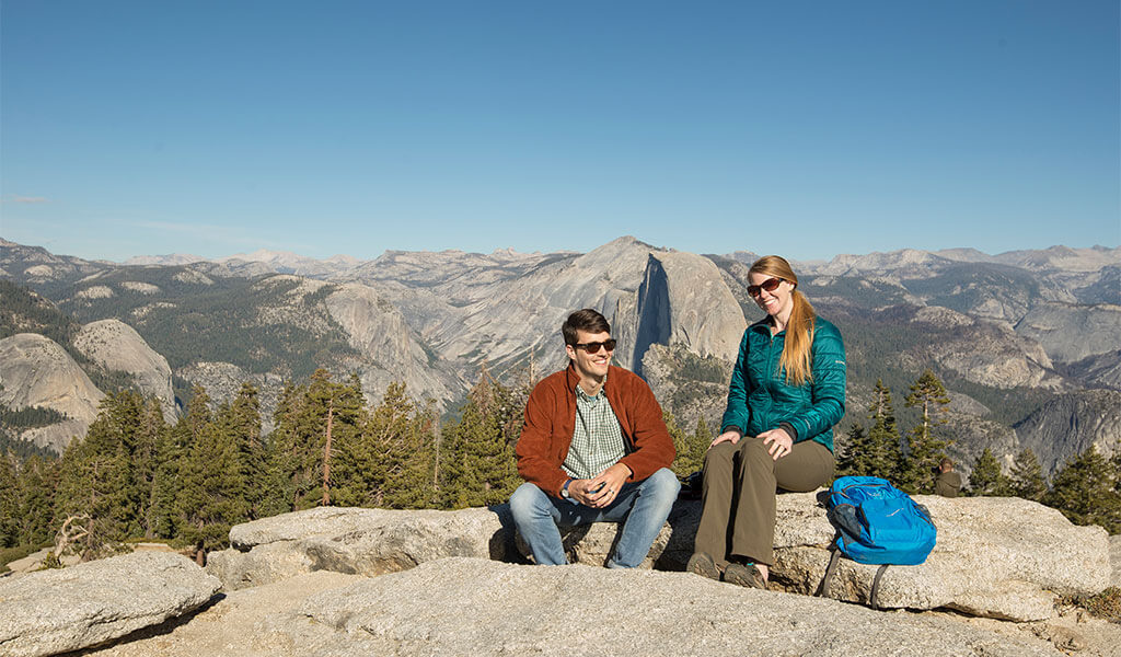
Half Dome
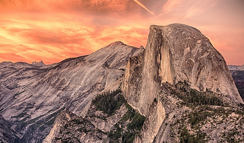
Half Dome may be Yosemite’s signature slab, a crest of granite rising above the Valley floor to an 8,844-ft. peak. This is one of the most well-known rocks in the world, its grand visage synonymous with the Yosemite “brand.” Half Dome is visible from much of Yosemite Valley, but for a special up-close encounter, take the two-mile Mirror Lake trail out and look skyward.
Three Brothers
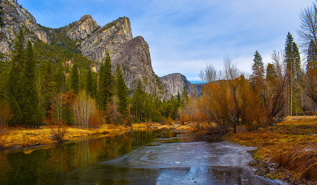
The tightly grouped, angular peaks near El Capitan on the Valley’s north rim are the Three Brothers, comprised of Eagle Peak (the uppermost “brother”), and Middle and Lower Brothers. View the Three Brothers from Yosemite Valley’s Southside Drive or along the Merced River at Cathedral Beach Picnic Area. According to legend, Three Brothers were named for the three sons of Ahwahneechee Chief Tenaya, who were captured near the base of the rocks by the Mariposa Battalion in 1851. The Valley Loop Trail offers postcard-perfect vistas.
Cathedral Rocks and Spires
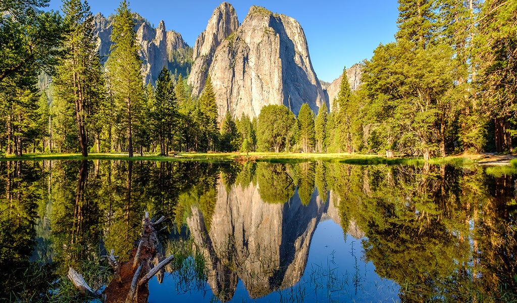
Cathedral Rocks and Spires rise above Yosemite Valley on the south rim, just across from El Capitan. The Spires resemble a two-towered Gothic cathedral, and the Southern Sierra Miwok found the lower rock reminiscent of a giant acorn. Numerous Southside Drive pull-outs look up to Cathedral Rocks and Spires, with the best vantage point near El Capitan Meadow. You can touch the base of Cathedral Rocks off the west loop of the Valley Floor Trail.
Lost Arrow Spire
Look closely, especially when Yosemite Falls is flowing, for Lost Arrow Spire – the detached granite pinnacle rising from the wall right of Upper Yosemite Fall. A prized peak for rock climbers (the first free ascent was telecast in 1985 on ABC’s Wide World of Sports), Lost Arrow Spire can be spotted from the Valley floor below as well as up-close from Yosemite Point at the top of Yosemite Falls Trail. As with many distinctive Yosemite landmarks, there is a poignant Yosemite Miwuk legend associated with “Hum-mo’,” or Lost Arrow, concerning a young couple who meet a tragic ending.
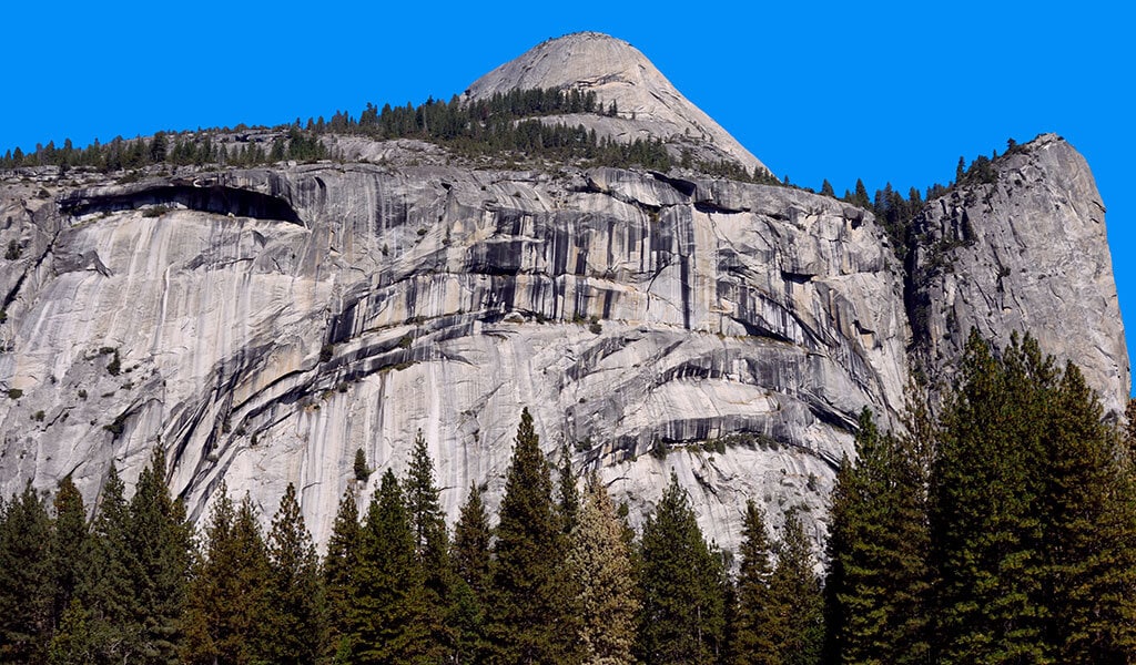
Sentinel Dome
Perched above Yosemite Valley’s south rim with panoramic views of everything from Yosemite Falls to Half Dome and Yosemite’s tallest peaks in the distance, Sentinel Dome is an 8,122-foot fan favorite for rock hounds worldwide. The popular trail in Yosemite’s Glacier Point region can be hiked out & back (just over a two-miler), or part of a loop to another rocky rim-side vista, Taft Point. The trail scales and circles the top of the giant granite dome, rendering the second-highest viewpoint above Yosemite Valley – only Half Dome is higher. Look west beyond Half Dome to see North Dome and Mt. Hoffman beyond (Yosemite National Park’s geographic center).
North Dome
Directly across Yosemite Valley from Half Dome, North Dome is a hefty chunk of granite that summits at 7,546 feet. While most enjoy it from Valley vistas below, strong hikers can take the North Dome hike that starts at Porcupine Creek Trailhead, off Tioga Road (closes seasonally for the winter). It’s an all-day hike of just over 10 miles round trip with a modest elevation gain on the return and a giant reward: a face-to-face view of Half Dome, just a few hundred yards away.
Lembert Dome
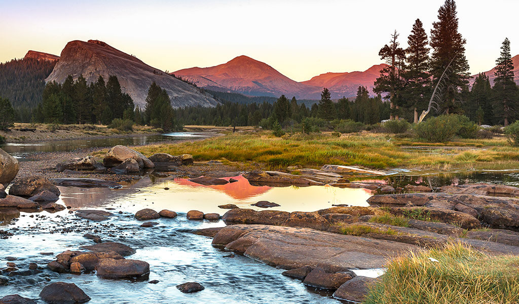
Ready to take it higher? Late spring through early fall when Tioga Pass is open, visit Northern Yosemite and Lembert Dome. Geologists will note that Lembert is not a true dome, but a roche moutonnée – an asymmetrical, glacier-formed figure. Make it a dome hike to the 9,455-ft. peak for a panoramic vista of Yosemite’s high-country majesty. Best trail access is from the Lembert Dome parking area or the Dog Lake Trailhead.
Granite to Gold: Discover Things to Do
California State Mining & Mineral Museum
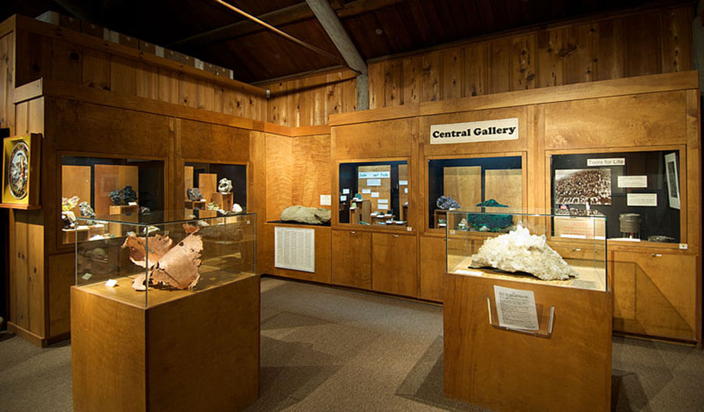
The California State Mining & Mineral Museum at the Mariposa County Fairgrounds offers a golden glimpse into the state’s mineral wealth, colorful mining history and geologic might. The Fricot “Nugget” is here — a spectacular 13.8-pound specimen that’s the largest remaining intact mass of crystalline gold from 19th century California.
Yosemite Climbing Museum & Gallery
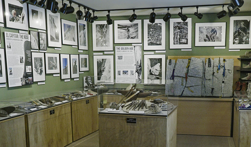
Discover rock climbing lore and legacy at the Yosemite Climbing Museum & Gallery, featuring more than 10,000 climbing artifacts including pitons used on early ascents of El Capitan and archival photographs. The museum and gallery are located just off Highway 140 in Mariposa.
Rock Climbing Classes and Guided Climbs
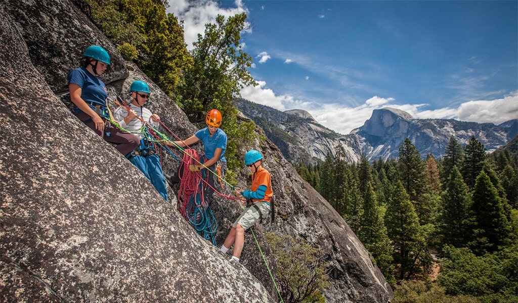
Since 1969, the Yosemite Mountaineering School & Guide Service has guided climbers, hikers and backpackers in Yosemite. They’re the perfect resource to “learn the ropes” via half-day, full-day, multiple-day, and customized climbing sessions. The school’s guides are the only ones authorized to lead and teach climbing at Yosemite National Park. Get a grip on the basics, including beginning climbing technique and rappelling, with the school’s popular “Welcome to the Rock” class.
Southern Yosemite Mountain Guides (SYMG) offers guided rock climbing, backpacking, and hiking trips and tours both inside the Park and across the Yosemite Mariposa County wonderland. Founded in 1991, today SYMG is one of the “Best Outfitters on Earth” according to National Geographic Adventure Magazine. SYMG’s five-day Rock Climbing Camp explores the great walls and domes of Yosemite Mariposa’s Sierra National Forest.
Rockin’ Accommodations
Highway 140 / Merced River Canyon
The Wild & Scenic Merced River is a geologic and hydrologic force that continues to shape the landscape. The river flows through glacially-carved canyons and over sheer cliffs through Yosemite Valley before exiting the Park and gaining torrential speed through the boulder bars of Merced River Canyon.
For a Yosemite bed & breakfast that is literally built into the natural riverside rock, check out the Retreat at River’s Edge in El Portal. This is an absolutely unique, nature-forward setting with four bedrooms and four baths, accommodating up to 12 guests.
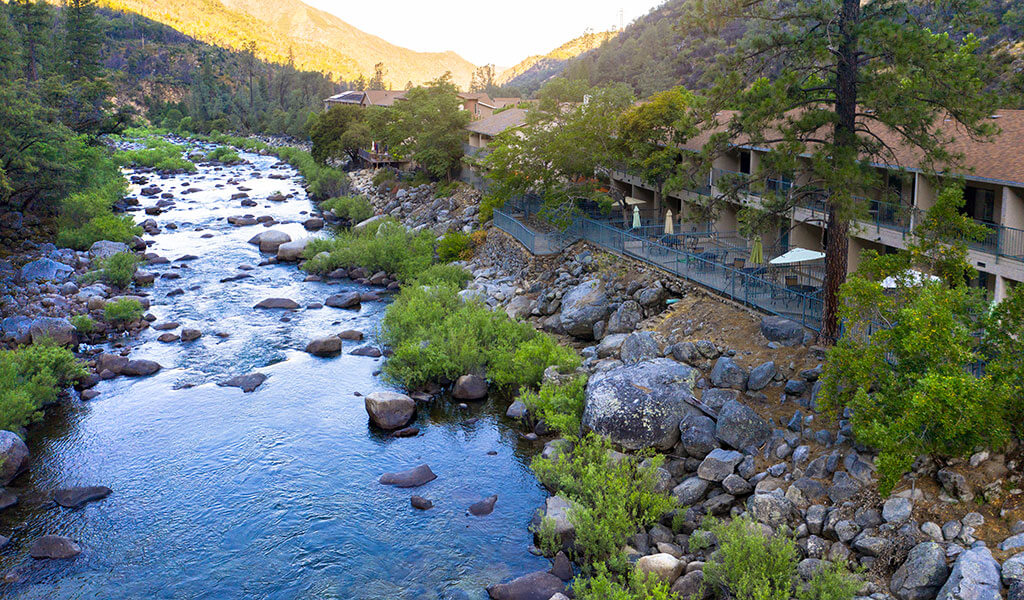
Also in El Portal, the riverfront Yosemite View Lodge features a dramatic riverside setting and is the closest resort to Yosemite Valley located outside Park gates. Balconies overlook the Merced River and the steep, rugged canyon carved out by the river. With two restaurant options, family-focused Parkside Pizza and The River, and multiple hot tub spas on property, the lodge has rock-solid amenities including the Yosemite View Convenience Store and EV charging outlets.
Yosemite Valley
Yosemite Valley offers easily observed titans of geology: vertical cliffs, high waterfalls, hanging valleys, and huge granite domes. The Valley’s geologic bona fides grace the Yosemite Valley Lodge, heralded for its rooms, amenities, and views of nearby Yosemite Falls. The property offers 245 available accommodations featuring Bunk Rooms and Family Rooms for the entire crew.
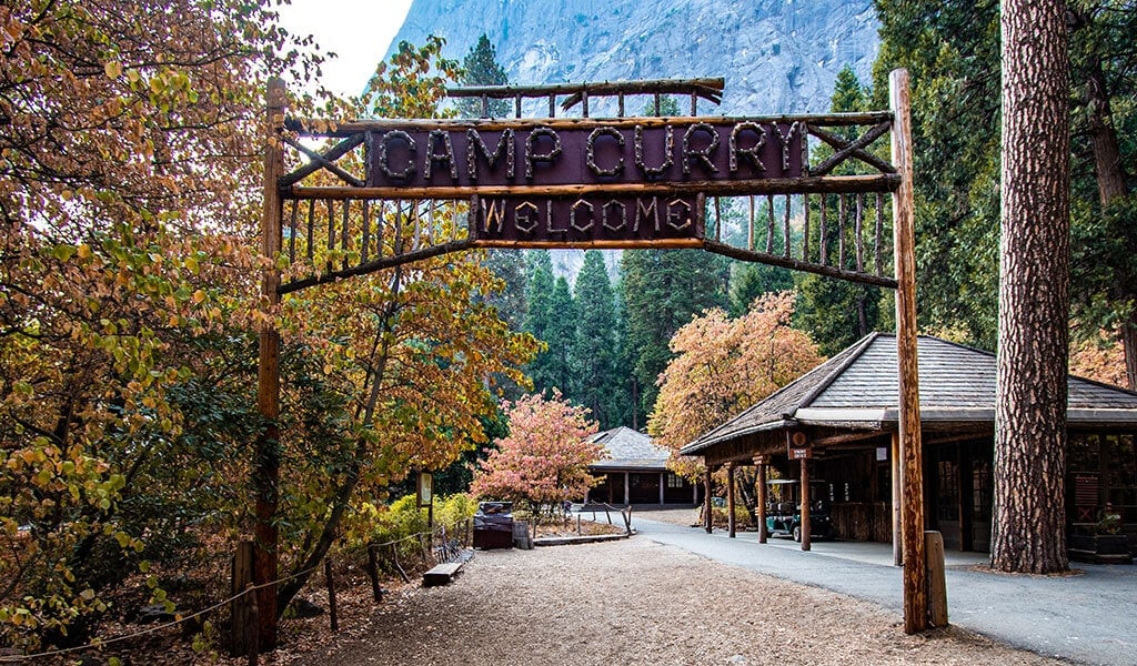
In the heart of Yosemite Valley, Curry Village is revered for the trademark hospitality of its founders, David and Jennie “Mother” Curry. “Camp Curry” was founded in 1899 and originally comprised of a dozen tents. Today, this National Historic District is still a prized place to stay. Curry Village features standard hotel rooms, wood cabins and wood-framed canvas tent cabins (some available with heating over the winter months). Numerous dining options and activities are available year-round.
Mariposa
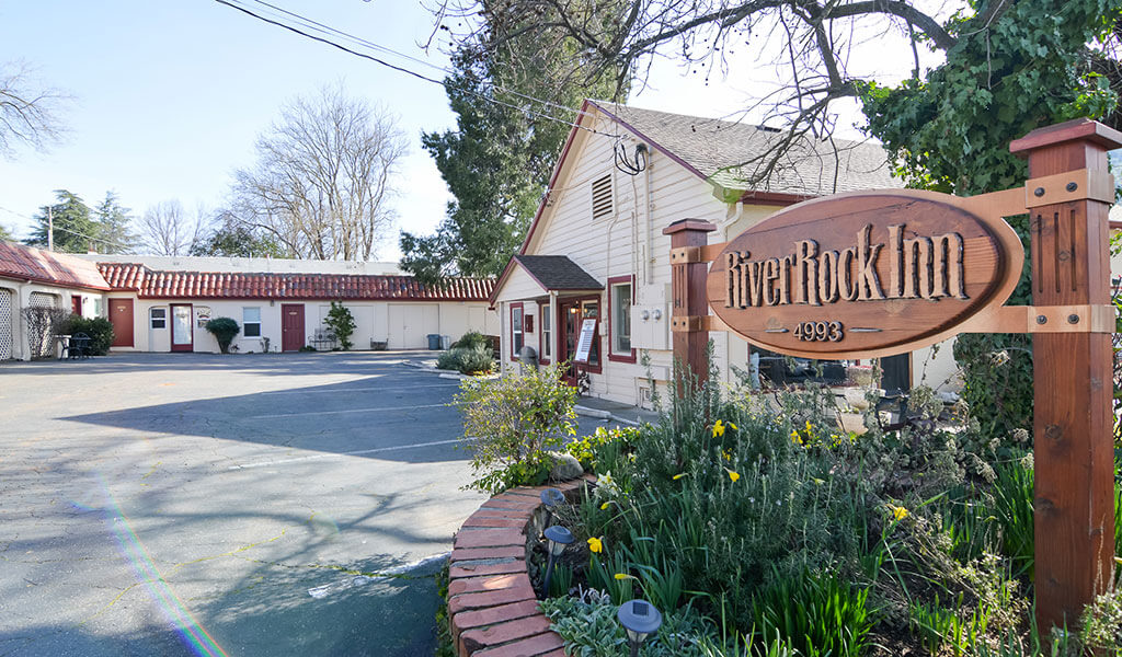
Tucked just off main street in the heart of downtown Mariposa, the historic River Rock Inn honors the geo-theme with nine rooms and suites, a verdant garden patio and onsite coffee shop, Sticks Coffee. The original structure at River Rock Inn was built in 1891 and became a hotel in 1941. As with most Mariposa hotels, it’s steps away from shopping, dining, drinks and the YARTS bus bound for Yosemite day trips.
To explore lodging options, things to do and places to eat, visit Yosemite.com, the #1 trip planning site for vacations to Yosemite National Park and historic Mariposa County. To stay up to date, follow @YosemiteNation on social media and subscribe to our newsletter, “The Wanderer”. Be sure to subscribe to our YouTube channel for great videos on the people and places of Yosemite Mariposa County.