


Stockton Creek Preserve Trail
Stockton Creek Preserve Trail
Central Mariposa County
CA-140, Mariposa, CA 95338, United States
Visit Website
Overview
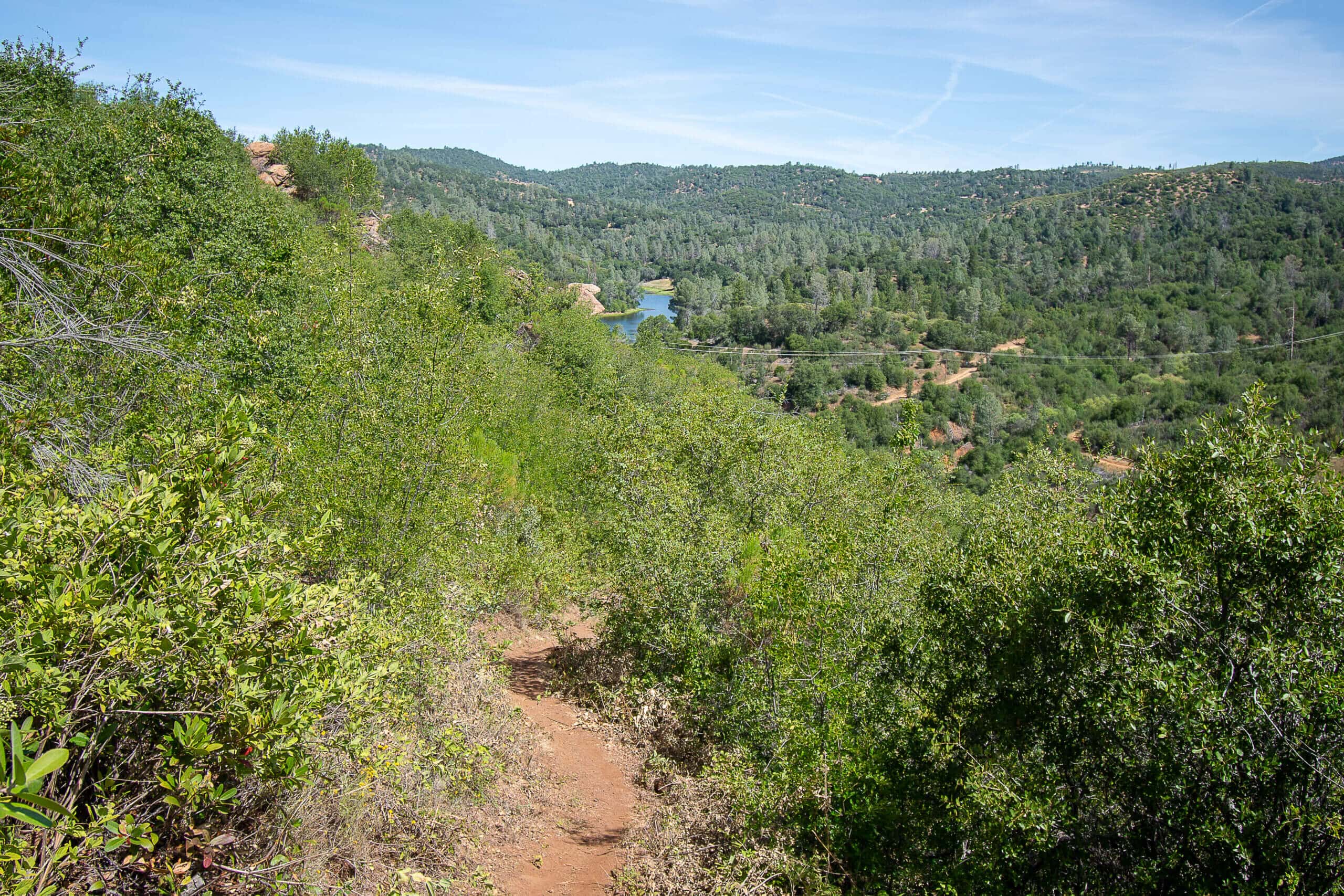
A project of the Sierra Foothills Conservancy, Stockton Creek Preserve is a rolling hike through the Sierra Nevada foothills that will get your heart pumping as you climb up and down the ridgeline that separates the town of Mariposa from the Stockton Creek Watershed. This hike features a small lake, the Stockton Creek Preserve, Stockton Creek and a waterfall. The trail is open for hiking as well as mountain biking.
Keep your eyes out on the trail for deer, squirrels and a number of different birds including California Quail, Ravens and the occasional Redtailed Hawk, Great Horned Own or Vulture. Keep an eye out underfoot as rattlesnakes are known to inhabit the area. A number of different fauna are native to the area as well including manzanita, a number of different wildflowers including the California Poppy.
In total, the hike will take you to as high as 2,508 and drops down as low as 1,963 feet. The trail was expanded to go down to Stockton Creek in 2019 which now provides options to make the trail more difficult for those looking for an extra workout. Wanna take it a bit easier? Follow the dirt road for a few miles of flat walking before climbing up the lake.
To access the Preserve, go to the western side of town on Trabucco Street. Park near the football field and walk around the gate and past the water treatment facility to find the trailhead.
Hiking directions:
Starting from Trabucco Street: Walk around the gate near the football field and head up the road past the water treatment facility until you reach the trailhead, which presents you with three options. Follow the road straight for an easy stroll through the canyon for a few miles before climbing up to the reservoir. Take the trail spur to the right to hike down into the canyon through switchbacks to Stockton Creek before crossing the creek and slowly making your way up out of the canyon to the preserve. The trail spur to the right is marked difficult with a metal sign on a post and climbs up to the highest point of the area. Any of the three trails will eventually bring you to the preserve. From there, hike back the way you came or follow the dirt road through the area to get back down to your starting point either via the road itself or through the lower trail.