In an effort to help you get up, get out and enjoy nature’s red carpet this summer, we’ve created a handy guide to Yosemite hiking trails with waterfalls. Let’s get started!
Yosemite Falls
Yosemite Falls is the collective name for three separate falls: Upper Yosemite Fall (1,430 feet), the middle cascades (675 feet), and Lower Yosemite Fall (320 feet). You’re in luck if you plan to experience Upper and Lower Yosemite Falls hikes in the near future. Yosemite Fall flows at it’s best between November and July.
“A waterfall is water that has awakened.” – Shelton Johnson, Yosemite Park Ranger. Check out our video below to learn more about Yosemite Falls.
Upper Yosemite Falls Hike
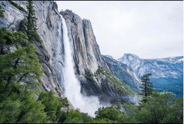
“Upper Yosemite Falls isn’t the easiest hike. In 3.5 miles it gains around 2700 ft. Two-ish miles into the hike you come to this view” – @MinaYoungLee
Built 1873 to 1877, Upper Yosemite Fall Trail is Yosemite’s oldest historic trail that packs a little bit of danger, a lot of elevation climb and America’s tallest waterfall into one spectacular hike. Cascading more than 2400 feet, Yosemite Fall will take away whatever breath you have left after your ascension. It’s recommended you set out on your journey pre-dawn to beat the sun and the foot traffic. With minimal tree coverage in the afternoon, come prepared with at least three to four liters of H2O.
Distance: 7.6 miles (12 km) round trip
Elevation: 3,967 feet (1,347m)
Difficulty: Strenuous, steep with many switchbacks
Time: 6-10 hours
Begin at: The trailhead can be accessed near Camp 4 off Northside Drive near Yosemite Valley Lodge.
Lower Yosemite Falls Hike
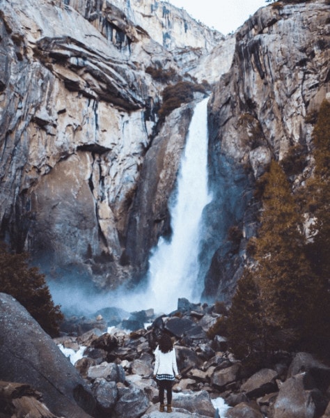
“It was dusk and we were the only people here” – @JuliaTrotti
Accessible year round, Lower Yosemite Falls Hike features the final 320-foot cascade of Yosemite Fall. With a flat, smooth trail, this hike is easily accessible for visitors with young children and pets.
Distance: 1 mile (1.6 km) loop
Elevation: 4,000 feet (1,200 meters)
Difficulty: Easy
Time: 30 minutes
Begin at: Shuttle stop #6
Strollers allowed, accessible year-round, leashed pets allowed, wheelchair accessible
View Lower Yosemite Falls Webcam
Vernal Fall and Nevada Fall
While it may not be the tallest waterfall in Yosemite, Vernal Fall packs one of the most powerful water-flow punches and is a site to see for hikers. Luckily, the 594-foot Nevada Fall is along the trek too! There are two hikes perfect for viewing both falls, Mist Trail and John Muir Trail. Be sure to stop and take in the rainbows along your journey.
“To go to places like Mist Trail, you get a rainbow without the storm.” – Steve Bumgardner, Filmmaker. Learn more about moonbows and rainbows at Yosemite’s waterfalls in the video below.
Mist Trail
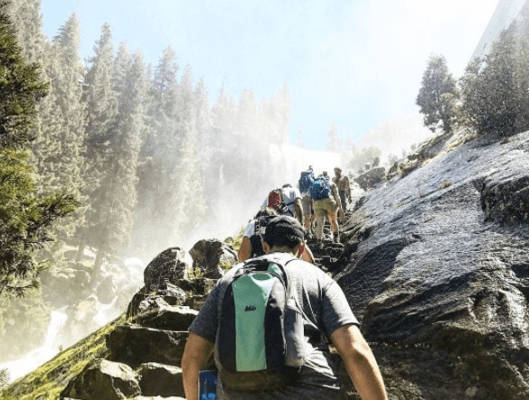
“Biked 15 miles, climbed up a waterfall & even river rafted 12 miles. Is this The Amazing Race or Yosemite?” – @HaleyFenner
True to its name, Mist Trail provides refreshing sprinkles of Sierra Nevada mountain water as hikers climb what’s known as nature’s “giant staircase” alongside the 317-foot Vernal Fall. Word of caution: Footing is slick up the half-mile granite stairway alongside Vernal Fall, as well as the preceding one and a half miles of rocky switchbacks of Nevada Fall Trail that leads to Nevada Fall. Proceed with caution as you gawk at rainbows within the sprays of each waterfall.
Distance: 3 miles (4.8 km) round trip to Vernal Fall, 7 miles (11 km) round trip to Nevada Fall.
Elevation: 4,000 feet (1,200m)
Difficulty: Moderate
Time: 2 – 5 hours
Begin at: Happy Isles, shuttle stop #16
John Muir Trail or Mist Trail
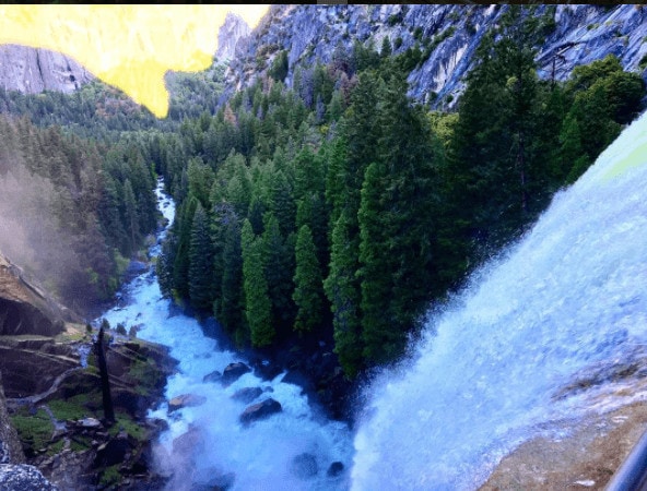
Photo Cred: @Elizabeth_Outdoors
“As long as I live, I’ll hear waterfalls and birds and winds sing. I’ll interpret the rocks, learn the language of flood, storm, and the avalanche. I’ll acquaint myself with the glaciers and wild gardens, and get as near the heart of the world as I can” -JM – @Elizabeth_Outdoors
According to the National Park Service, from 2011 to 2015 there has been a 100 percent increase in John Muir Trail Permits requested. While to do the entire 210 miles of JMT is more ambitious then you were probably planning, you can enjoy this very famous and scenic portion of the trail, also known as The Mist Trail. No permits are required to hike this trail just for the day.
With attractions like Vernal Fall, Nevada Fall and Liberty Cap along the path, it’s easy to understand why it’s one of Yosemite’s most popular trails. Continuing from Mist Trail, John Muir Trail leads hikers on a four-mile alternative route back towards Yosemite Valley. Along the trail are spectacular views of not only Nevada Fall, but another of Yosemite’s most popular attractions, Liberty Cap.
Distance: 4 miles one way (via Mist Trail)
Difficulty: – Moderate
Begin: Diverge from Mist Trail
Time: 5-7 hours from Mist Trail back to Yosemite Valley
Panorama Trail
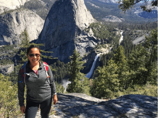
“When your quest to hike three waterfalls turns into a 15-mile adventure! Grueling, but gorgeous, hike today. And we stumbled (me, pretty much literally) upon one of the prettiest views in the entire park – off the Panorama Trail on the way to Illilouette Fall” – @zaratv
At 8.5 miles in length, the Panorama Trail is perfect for visitors looking for a bit of a challenge while viewing a combination of Yosemite’s most popular waterfalls: Yosemite Falls and Vernal Fall. Along your journey, keep an eye out for the male Blue Grouse. He’ll be showing his hottest dance moves and brightest colors for the lady grouse of Yosemite. A couple words of caution: With majestic waterfalls come free showers for passersby. Prepare yourself with a light jacket for the final section of the hike that follows Mist Trail by Vernal Fall.
Distance: 8.5 miles/13.7 km one-way to Valley floor (via Mist Trail)
Elevation: 3,200 feet/975 m descent
Difficulty: – Strenuous (very difficult in winter due to significant snow)
Time: 6 hours
Begin at: Panorama Trailhead, Glacier Point (trails ends at Happy Isles in Yosemite Valley).
Similar Articles:
Tips for Getting the Most Out of Your Yosemite Visit in Summer
Packing for a Yosemite Day Hike
Bridalveil Fall
At 620 feet, Bridalveil Fall is often the first waterfall visitors see when entering Yosemite Valley. As one of the easier hikes in the Valley, Bridalveil Fall is the perfect attraction for visitors looking for minimal effort in return for maximum views.
“It’s really one of the best walks in the Valley because you’re going from one world to another.” – Shelton Johnson, Yosemite Park Ranger. Learn more about Yosemite’s easy day hikes in the video below.
Bridalveil Trail
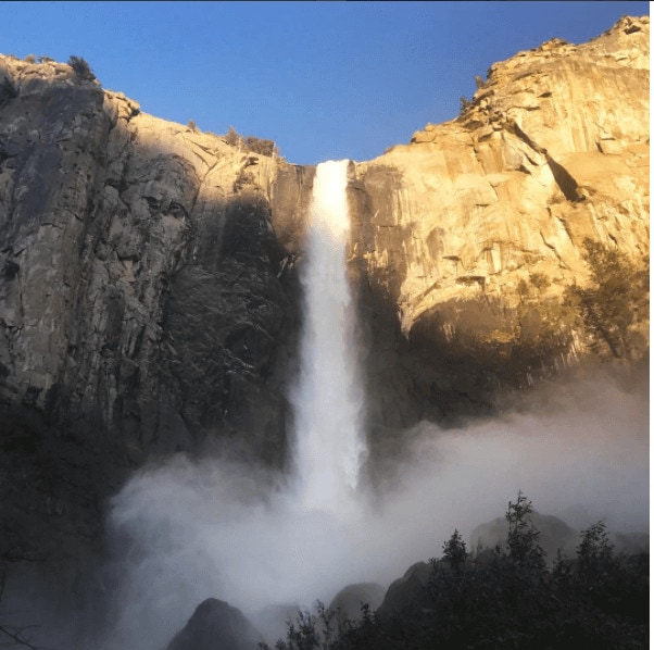
“Another day of waterfalls (and basically free showers).” – @vvnteng
Fully paved from the parking area to the waterfall, Bridalveil Trail allows easy access for visitors with young children and pets. The walk from the parking lot to the Fall is about 20 minutes. Unfortunately due to its grade, this trail is not accessible for visitors using a wheelchair.
Distance: 0.5 mi (0.8 km) round trip
Difficulty: Easy
Time: 20 minutes
Begin at: Bridalveil Fall Parking Area
Chilnualna Falls – Wawona
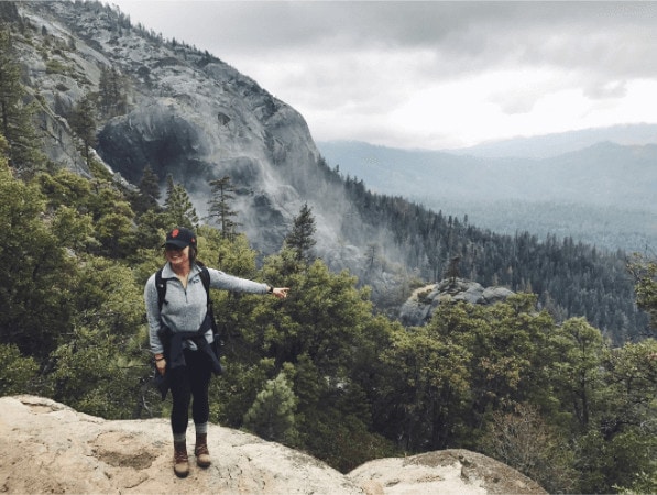
“Yeah, DAT WAY. We survived the storm at Yosemite this weekend y’all‚ and def chased that waterfall.” – @victoreea
Just beyond the Yosemite Valley floor is Chilnualna Falls (pronounced chill-na-wall-na). The trail to the Falls is a strenuous one. Make sure to pack enough water for a full day of hiking. If you can’t make it to Chilnualna Falls this summer, not to worry. This is one of the rare falls that flows year round.
Distance: 8.2 miles/13 km roundtrip
Elevation: 2,400 feet
Difficulty: – Strenuous
Time: 6 hours
Begin at: Chilnualna Falls parking area, two miles up from Chilnualna Falls Road.
Learn more about the best Yosemite hikes, or visit our featured hikes page to learn about more Yosemite hiking trails. While you’re hiking in Yosemite this summer, share your adventures with us by using the hashtag #YosemiteNation. Along with your amazing photos, share a little about why you enjoy each hike.
